By John Page Williams
Back Bay has been a paradise for both wildlife and humans for at least 3,000 years. This water lies in a nearly 65,000-acre shallow pan, tucked into extreme southeastern Virginia between the coastal barrier beach (think Sandbridge, Back Bay National Wildlife Refuge, and False Cape State Park) and Pungo Ridge to the west, a dune line left from an ancient ocean millions of years ago. The Bay is the northern extension of North Carolina’s Currituck Sound, connected to the Atlantic Ocean only through Oregon Inlet, more than 60 miles to the south. The result of this geography makes Back Bay a vast expanse of skinny fresh and mildly brackish water dotted with marsh islands. Wind, rather than moon, drives its tides.
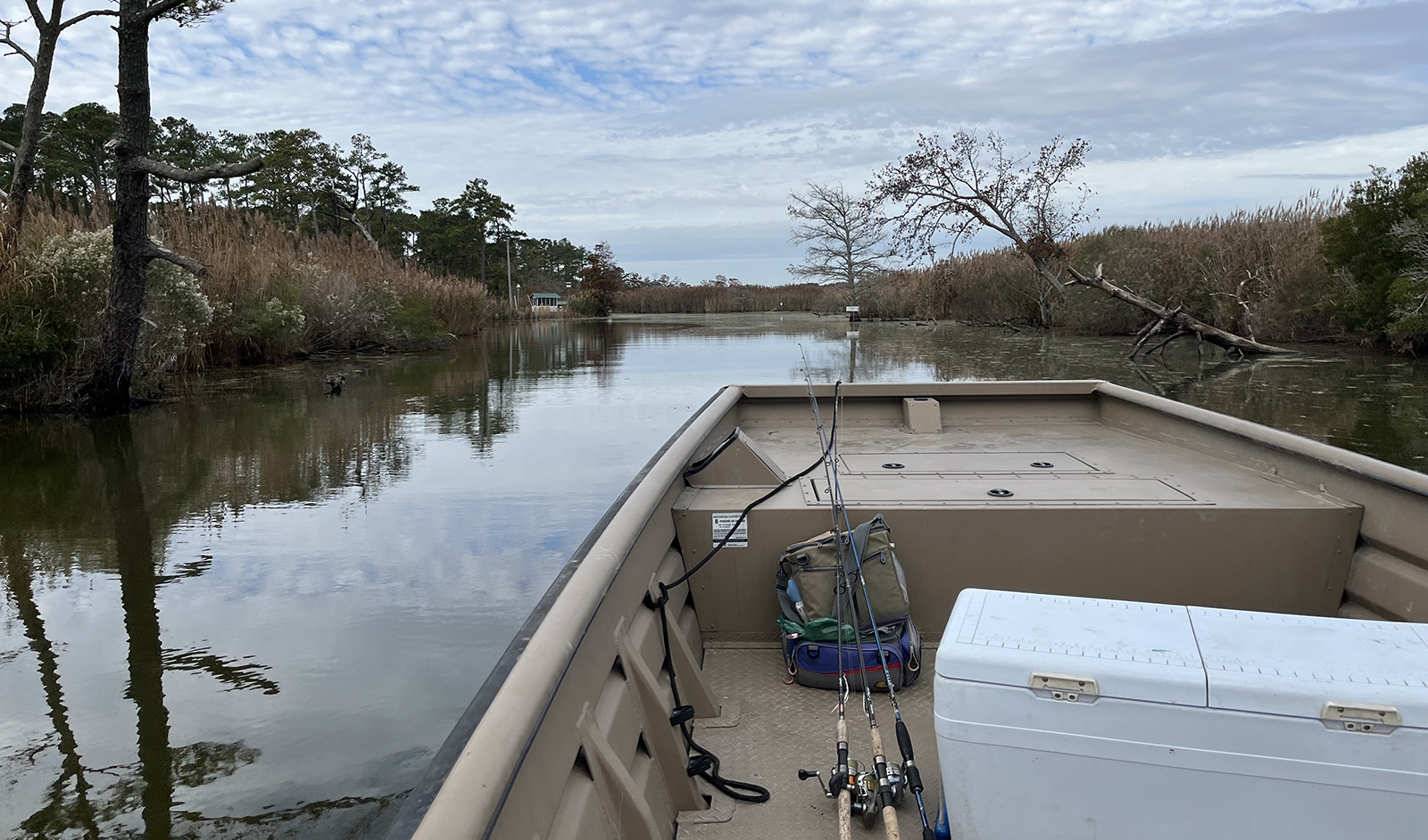
We visited Back Bay in early November to see for ourselves with Chad Boyce, the regional fishery biologist for the Virginia Department of Wildlife Resources (DWR). He offered a tour aboard his big johnboat, launching from Mill Landing, the northern one of two DWR public access facilities in Virginia Beach. Rimmed by stands of loblolly pine, live oak, American holly, and other hardwoods, with black gum, bald cypress, and big cordgrass growing at its edges, the Bay offered creeks, marsh edges, shaded coves, fallen trees, and meadows of underwater grass. These features furnished rich habitat for forage like killifish (locally called gudgeons), spottail shiners, bay anchovies, and Atlantic silversides, as well as juvenile bass and perch.

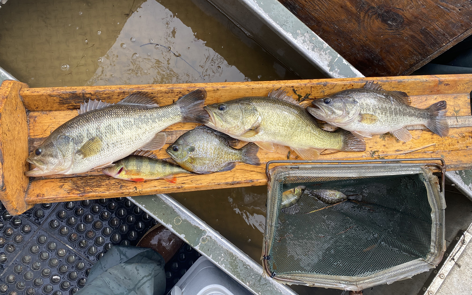
Back Bay’s fish populations include largemouth bass, yellow perch, and bluegill. Photo by Chad Boyce/DWR
Native largemouth bass, chain pickerel, black crappies, yellow perch, and white perch fed heartily and flourished. The acres of underwater grass beds offered wild celery, redhead grass, sago pondweed, naiads, and coontail to migratory waterfowl that piled in each winter from their northern breeding territories. From the late 19th century, Back Bay was nationally known for its robust stock of largemouth bass and its wintering waterfowl. Anglers and duck hunters flocked to its fish camps and duck clubs.
As Boyce piloted the boat south from Mill Landing into the broad expanse between the National Wildlife Refuge to the north and Knotts Island to the south, he explained that Back Bay’s primary freshwater source is rainwater from what was once sandy, swampy woodland. Today, the bay is surrounded by Pungo farmland to the west, Virginia Beach suburbia to the north, and the intensively developed, 80-year-old Sandbridge resort to the east. Though market hunters harvested countless ducks early on, conservation laws in the early 20th century stabilized the stocks somewhat.
In 1938, the U.S. Fish & Wildlife Service (USFWS) established the Back Bay Refuge on the eastern side of the Bay, including a five-mile swath of open water and marsh, plus 4 ½ miles of dunes and Atlantic beachfront. Its purpose is and always has been to protect and provide habitat for an impressively long list of wildlife species. First and foremost are migrating and wintering waterfowl (gadwall, greenwing teal, bluewing teal, wigeon, mallards, black ducks, shovelers, wood ducks, scaup, redheads, tundra swans). The list, however, includes many other birds (shorebirds, herons, ospreys, bald eagles), reptiles (cottonmouths), amphibians (bullfrogs, coastal plains leopard frogs), and mammals (bobcats, whitetail deer, river otters, raccoons, muskrats).

Back Bay’s ecology has been dramatically affected by development over the years.
The bass fishery gained national prominence, especially as anglers flocked to it in the decades after World War II and into the boom in bass-fishing popularity of the 1970s and early ’80s. Those with advanced skills recorded catching more than 100 bass in a day. “Stringer shots”—photos displaying dozens of caught bass—were all too common. In 1980, Back Bay anglers registered 240 citation bass of eight pounds or more—all harvested for weighing on certified scales.
However, Boyce explained, even the most robust, bass-friendly ecosystem couldn’t withstand that kind of fishing pressure, especially when it also faced environmental threats. Back Bay’s fishery collapsed in the mid-‘80s, thanks also to damage from human development that included intensive agriculture on the west side and encroaching suburbia to the north and east. Extensive ditching to drain former wooded swampland for farming between Pungo Ridge and the Bay brought runoff of sediment, fertilizer, and other chemicals into the creeks on the west side, exacerbated by discharge from large hog farms. Runoff from housing development on the north end grew in the 1960s and ‘70s as the City of Virginia Beach expanded, while on the east side, Sandbridge grew from a few small summer cottages into a large, dense community.
Back Bay became cloudy with sediment and algae growth that blocked light from the underwater grasses. Their meadows died. The effort to revive them included a well-meaning but misguided program to pump seawater over the dunes from the Atlantic. It raised the system’s salinity enough that bass spawning cratered. Thus, the crash after the crest of citations in 1980. The rest of that decade and the ’90s were dismal for fish, waterfowl, and people. The pumping program stopped.
As we ran south toward Knotts Island and the North Carolina line, Boyce described how today, Back Bay’s health is improving significantly. Thanks go to conservation of natural lands around it, including DWR’s Princess Anne Wildlife Management Area, which we passed on the west side, and improved environmental practices on farmed and built-up land. Concurrent with the environmental improvements, several years of drought in the 2000s reduced water flow—and therefore runoff pollution—enough for some of the grasses to start restoring their meadows.

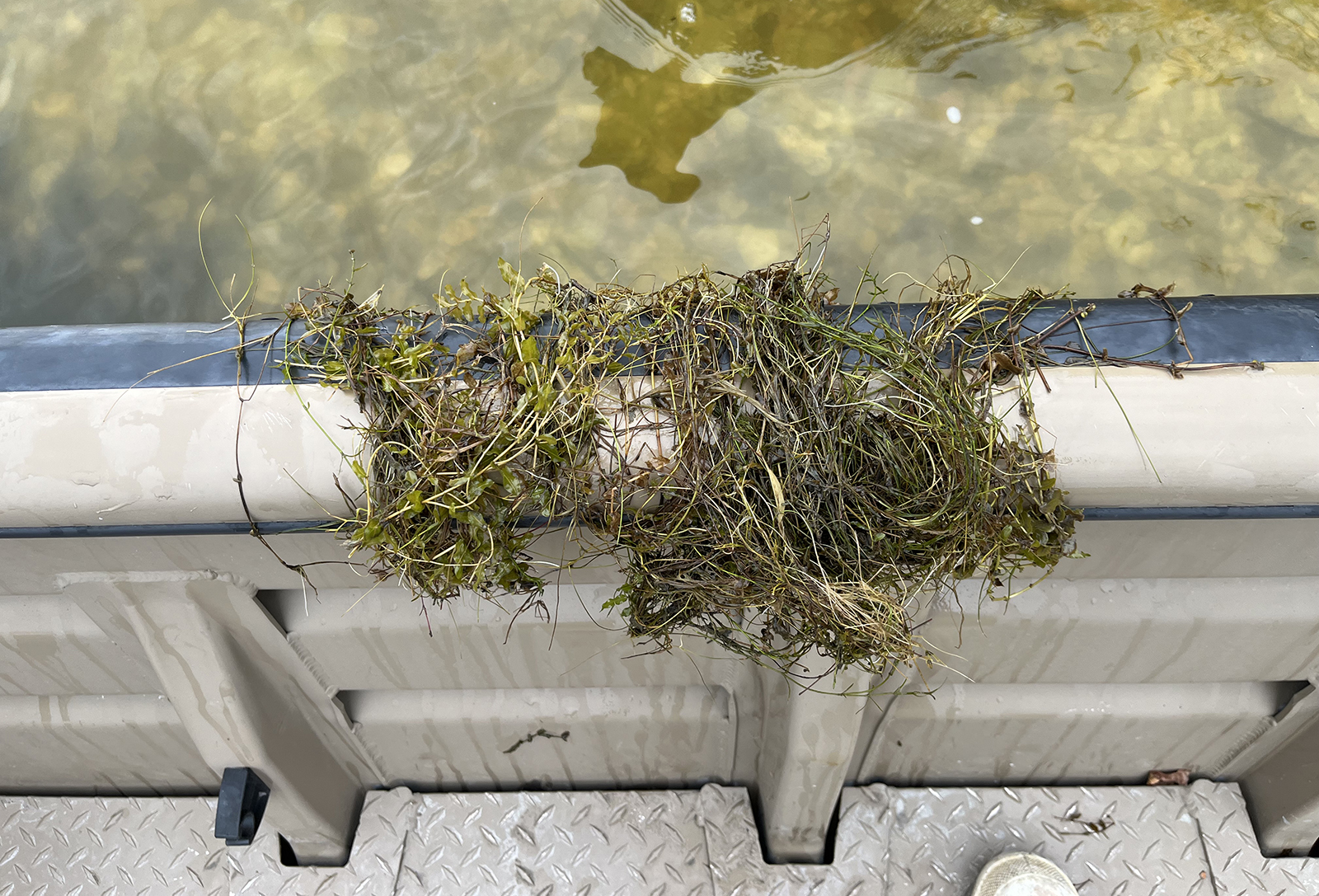
Back Bay’s submerged aquatic vegetation is recovering, and provides habitat and forage for wide varieties of fish populations. Photo by John Page Williams
There was also some serendipity in improving natural reproduction of the Bay’s beloved largemouth bass. In 2009, DWR received 70,000 largemouth fingerlings that were surplus from another program and stocked them into Back Bay. Careful monitoring over a couple of years showed enough good survival to justify a larger, three-year investment in stocking 375,000 more in the early ‘teens. At the same time, natural reproduction took off again. Today, according to Boyce’s electroshocking surveys, Back Bay’s stock of largemouth bass appears as strong again as it was in the early 1980s, though it will take more time for numbers of them to grow to citation size.

DWR’s fisheries biologist Chad Boyce holding up some largemouth bass captured during electrofishing surveying. Photo by Chad Boyce
“Now I’m going to show you something unusual,” Boyce said as he steered the boat to the south end of Little Cedar Island, a tiny marsh tump within sight of the houses on the north (Virginia) end of Knotts Island. He ran the skiff’s bow onto a little beach and said “Look down.” There on the bottom was a spread of oyster shells. “At some point many years ago,” he said, “this end of Back Bay was connected to the ocean by inlets. The inflow of salt water then allowed these oysters to establish themselves. They grew old. Look how thick some of these shells are. But there haven’t been any live ones here for several centuries.” As we probed around, we also found a mixed stand of underwater grasses: redhead, sago, a naiad, and coontail. We also noted that several local boatmen were brushing blinds to prepare for the upcoming gunning season. Boyce, an avid waterfowler and decoy maker himself, chuckled as he described his own blind.

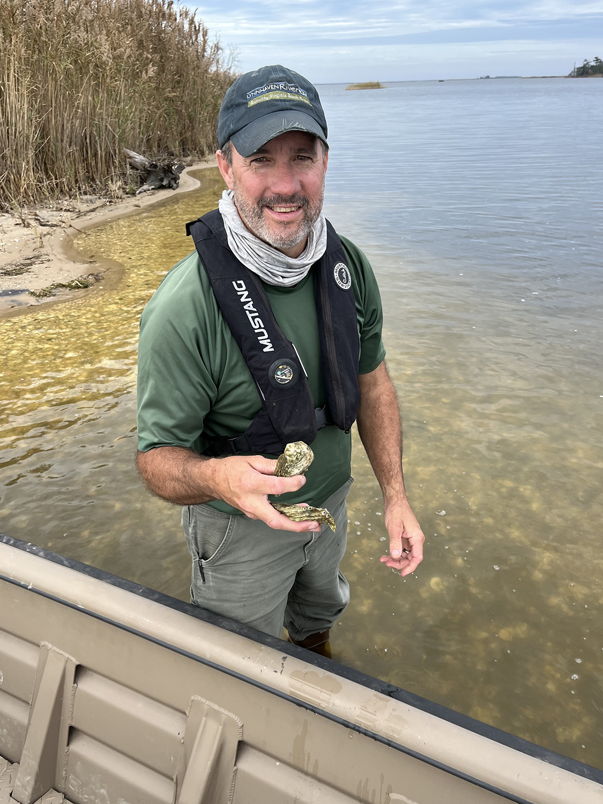
DWR’s Chad Boyce holding some oyster shells scooped up from the bottom of Back Bay. Photo by John Page Williams
On the way back to Mill Landing, we ran up the canal at the Princess Anne Wildlife Management Area to see the ramp there and the former duck club that serves as DWR’s regional office. We also took a side trip into Nawney (“Nanney”) Creek to see if we could talk one of the Bay’s bass into bending a rod. No luck, though, in spite of plenty of habitat around docks and marsh points. Clearly, we’ll have to go back. The bass feed all year here. Moreover, spring brings great fishing in the creeks and canals for pickerel, both species of perch, crappie, and, yes, bass. Back Bay is on the mend! Come see for yourself.
John Page Williams is a noted writer, angler, educator, naturalist, and conservationist. In more than 40 years at the Chesapeake Bay Foundation, Virginia native John Page championed the Bay’s causes and educated countless people about its history and biology.


