
By John Page Williams
Photos by John Page Williams
Surry County’s Gray’s Creek is a gem with state Scenic River status hiding in plain sight directly across the James River from Jamestown and hard by the southern terminus of the Virginia Department of Transportation’s (VDOT) no-cost-to-passengers Scotland-Jamestown Ferry. It has been a treasure to us humans for at least a millennium.
Prior to 1607, Native people would have found the creek and its tributaries rich in spring with yellow (ring) perch, white (stiffback/gray) perch, river herring (alewives and bluebacks), and hickory shad. The main river would have swelled with American shad, striped bass (rockfish), and Atlantic sturgeon (which also have a fall run). Now it also holds largemouth bass, black crappie, and blue catfish. A friend joined me in my skiff to explore it on a clear day in mid-October. We launched at DWR’s Gray’s Creek Landing near the mouth, beside the Surry Seafood Company’s Restaurant and Marina.
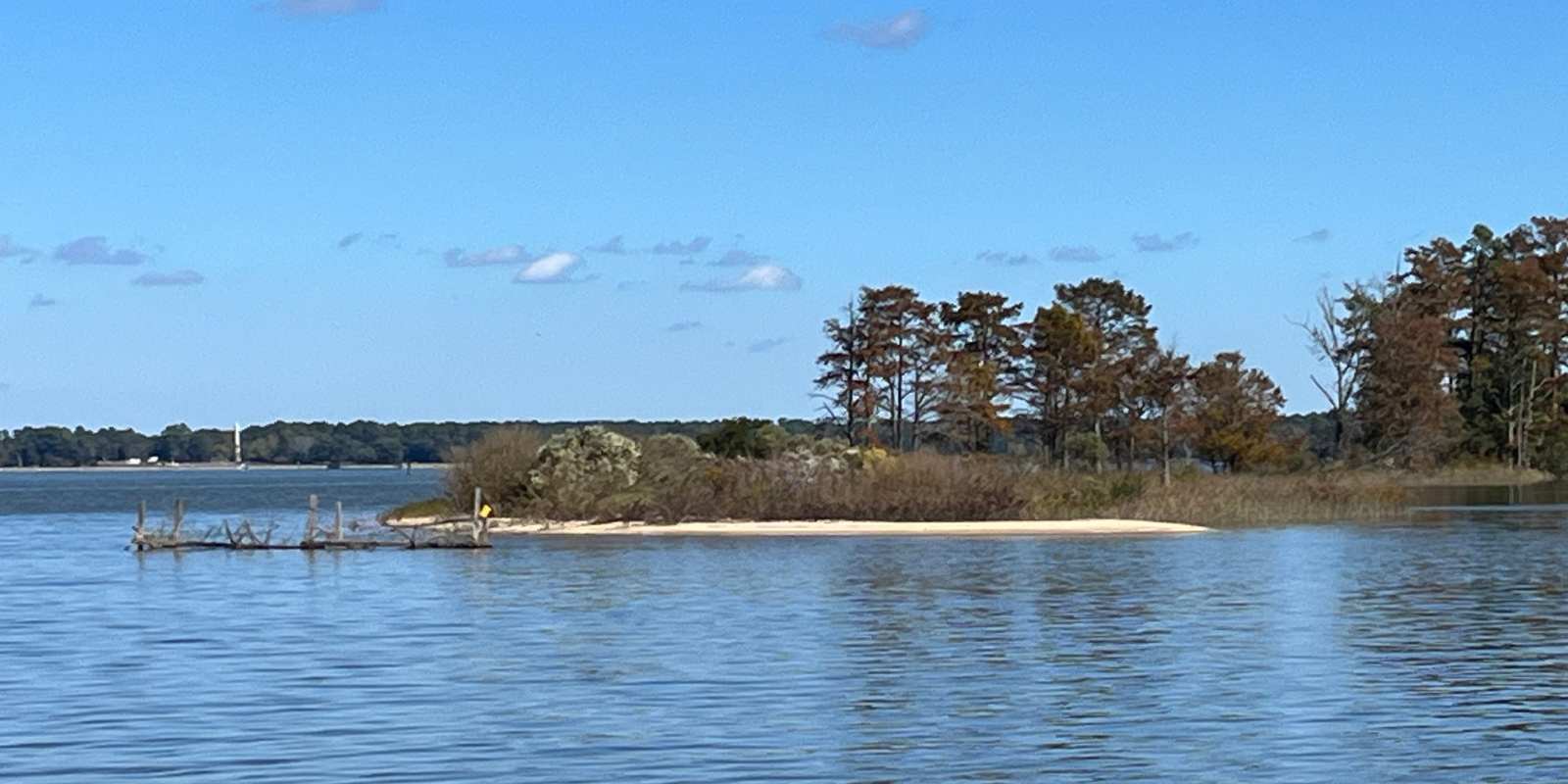
The mouth of Gray’s Creek, looking toward Jamestown.
The origin of Gray’s Creek is Dark Swamp, a large, forested wetland that extends from its crossing under Route 10 just west of the Town of Surry north to a bridge on Route 626 (Lebanon Road). That sprawling headwater swamp forms an effective filter, valuable for water quality downstream. Below the Rt. 626 Bridge, Gray’s Creek meets sea level. Its freshwater forested/shrub wetland turns to riverine tidal fresh marsh. Rimmed by bald cypress trees, the creek channel flows six miles to the James River, though as the osprey flies, the distance point-to-point is just three miles.
For the Native people who lived here before the English came, the firm land on the outsides of its meander turns made natural sites for villages, farm fields, and woods for hunting for game like deer and turkeys. The marshes on the inside turns offered edible plants for foraging and waterfowl and furbearers for trapping. Freshwater springs flowed from the creek’s headwaters and high banks. Near the mouth, the creek turns brackish. It comes by its Scenic River designation honestly, with wide buffers along its forested shorelines, acres of wild rice and other seed-bearing tidal fresh plants, and numerous side branches to explore, especially in paddlecraft.
At half-tide, we explored all the way up to within a quarter of a mile of the Rt. 626 Bridge. Our trusty four-stroke outboard made it easy to explore the whole creek in a day, but the marsh guts and side creeks make Gray’s a great waterway for exploring by canoe, kayak, or paddleboard.
The Gray’s Creek marsh would have been beautiful in mid-August. The six- to eight-foot-tall rice plants would have bent under full tops of grains, surrounded by more seeds and grains from dotted smartweed, tearthumb, rice cutgrass, and Walters millet. Wild marsh flowers in bloom would have included white autumn clematis, bright red cardinal flower (lobelia), purple pickerelweed, plum-colored ironweed, and orange jewelweed. Mid-October, though, is a transition time, with the rice and other seed-bearers spent and beginning to fall. The marshes were turning brown, and the color was in the trees: red, orange, and purple in the maples, oaks, and gums, and russet heather in the cypresses. Soon, windy cold fronts will bring migratory birds to feed on the bumper crop of seeds and grain, with many waterfowl staying for the winter because of them. The creek’s ospreys had departed for their “other summer” in Central and South America, but we saw several resident bald eagles and great blue herons.
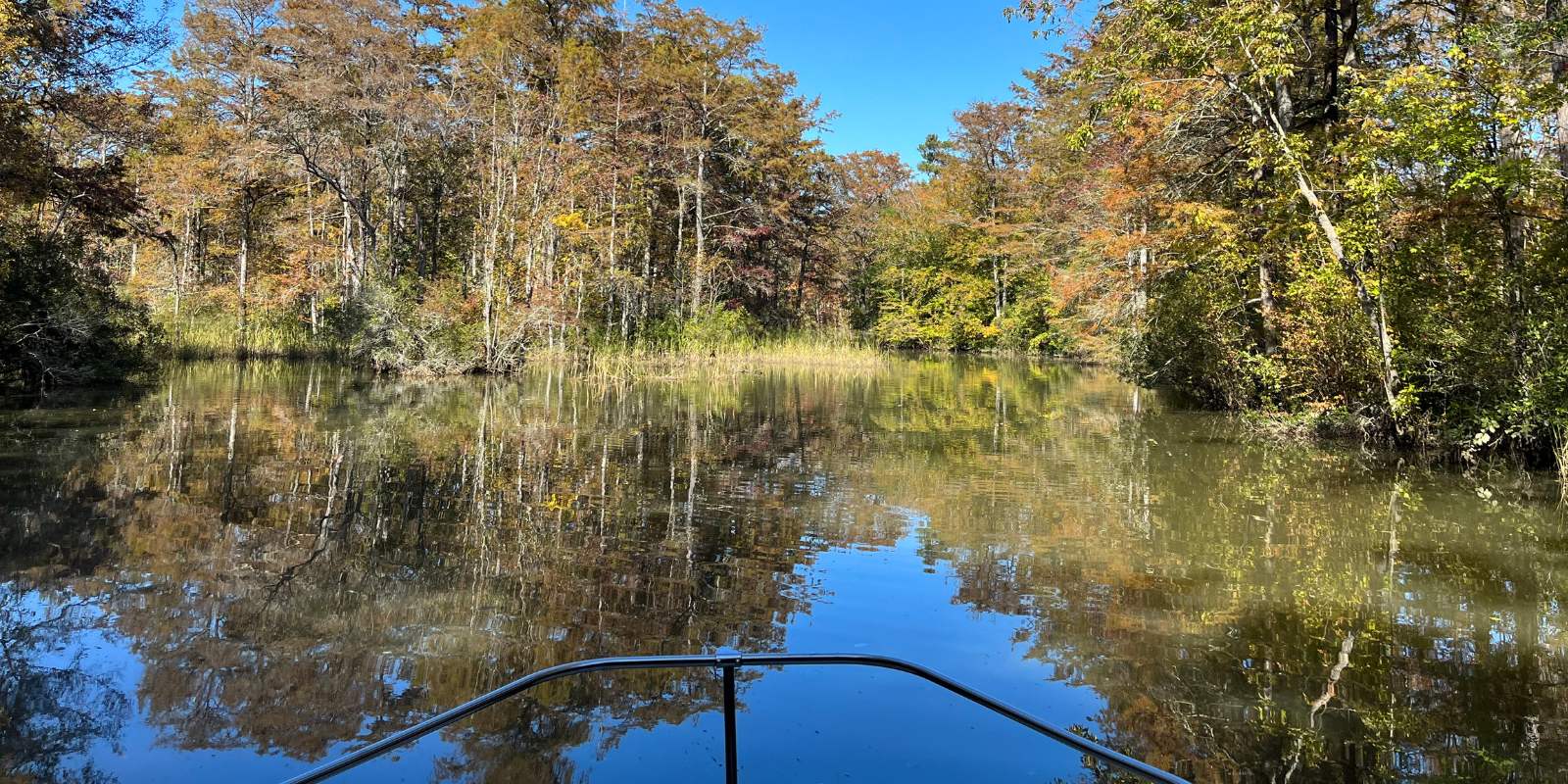
The upper portion of Gray’s Creek.
When the first English settlers sailed up the James River in 1607, they first landed on the south side of the river near the present town of Claremont in Surry County a short distance upriver from Gray’s Creek. Here, they visited the Quioughcohannock Indians, allies of the Powhatan Confederacy. The English reported that they were graciously entertained during this first visit with the Native American inhabitants. These settlers, of course, went on to establish the first English colony in the New World across the James on Jamestown Island (which they at first called James Fort).
English settlement along Gray’s Creek began in 1609 when Capt. John Smith ordered an additional defensive fortification called the “New Fort” (marked on Smith’s 1612 map), to be built on it to guard against attacks from Natives and Spanish. He planted a Maltese Cross in the wooded swamp at the headwaters (which makes it part of the Captain John Smith Chesapeake National Historic Trail). The fort was never completed (the colony became distracted during The Starving Time), but the earthworks of the fort remain visible high on the eastern bank overlooking Gray’s Creek. Preservation Virginia now owns the site.
The land on Gray’s Creek’s eastern side was part of Chief Powhatan’s dowry land endowed for his daughter Pocahontas’ marriage to John Rolfe in 1614. The creek was first named Smith’s Fort Creek and then Rolfe’s Creek. On March 22, 1622, hostile Native Americans throughout the colony rose up in coordinated rebellion to rid their lands of the English. One young Native man warned an Englishman who lived on the creek, Richard Pace, of the impending massacre. The ambush killed more than 300 colonists up and down the James, but Pace crossed the James just in time to alert the people at Jamestown, thus saving many English lives.
The Virginia Company listed 16 settlers on the south side of the James opposite Jamestown in May of 1625. By 1639, Gray’s Creek had taken its name from Thomas Gray, who had patented land at the mouth. Gray was the son-in-law of Virginia’s Governor, Sir Thomas Gates. In 1652, the House of Burgesses separated the south bank land from James City County and named it for the English shire of Surry. A ferry crossed the James River from Jamestown to Gray’s Creek as early as 1660. The Burgesses established the town of Cobham in 1691 on the James at the creek’s mouth. Cobham was a port with a network of streets including houses, stores, taverns, riverfront tobacco warehouses, and a wharf. It died out in the late 19th century; today its name survives in the James’s broad embayment extending downriver past Chippokes Plantation State Park (farmed continuously since 1619) to Hog Island.
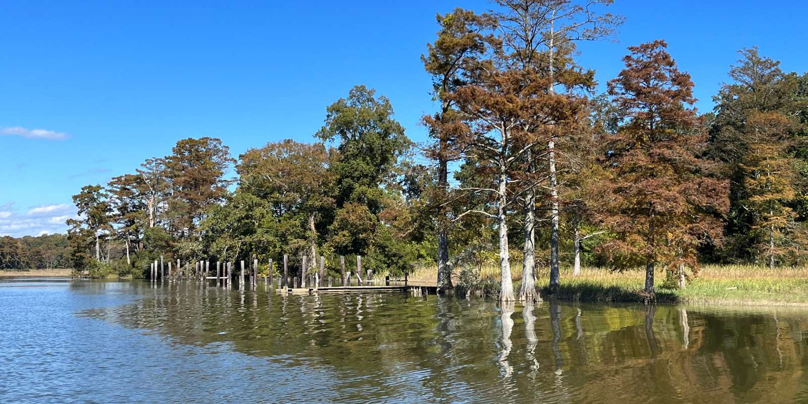
An old wharf on Gray’s Creek.
The deep channel in Gray’s Creek has always been valuable for transportation, including for shipping lumber, tobacco, and other crops like peanuts, corn, and cotton. During Cobham’s heyday, in 1761, merchant Jacob Faulcon built a brick manor house on the Smith’s Fort land. In 1886, a collective group of Black families purchased the house and 521-acre farm around Smith’s Fort, and they prospered there. In 1928, they sold the farm and the brick merchant’s house to Colonial Williamsburg and started a successful business in Richmond. Preservation Virginia received the deed to the house and 20 acres in 1933 and has cared for it ever since. Smith’s Fort has many stories to tell.
Today, Gray’s Creek looks largely the way it has for centuries, inviting exploration, birding, botanizing, and fishing by skiff and paddlecraft. It’s readily accessible from Hampton Roads and Richmond, including by a 25-minute ride aboard the Scotland-Jamestown Ferry. In season, Surry County’s Parks and Recreation Department offers kayak tours. The public landing also offers a fishing pier, and the adjacent Surry Seafood Company a restaurant with four-room hotel and full-service marina.
John Page Williams is a noted writer, angler, educator, naturalist, and conservationist. In more than 40 years at the Chesapeake Bay Foundation, Virginia native John Page championed the Bay’s causes and educated countless people about its history and biology.