
By John Page Williams
Photos by John Page Williams
From the Rt. 17 bridge at the eastern entrance to the town of Tappahannock, Hoskins Creek looks commercial, surrounded by businesses and their parking lots. Tall, invasive Phragmites reedgrass in its marshes speaks of soils disturbed by construction. A quarter-mile downstream loom the five big tanks of Perdue Agribusiness’s Tappahannock Grain Terminal, storing corn, wheat, barley, and soybeans that are waiting for a tug to push a barge load out of the creek, down the Rappahannock, across the Chesapeake, and up the Wicomico to the company’s feed mill in Salisbury, Maryland.
But Hoskins Creek, like several other Rappahannock tidal tributaries, drains a large watershed. It begins as a tiny stream at the southwestern edge of Essex County, 150 feet above sea level, gathering rainfall while running eastward for 12 miles (as the eagle flies, but more than 25 as the creek flows), draining deep timberland pocked by a handful of farm fields and several old millponds. In May, a friend and I launched my skiff at the boat ramp on the creek maintained by the Virginia Department of Wildlife Resources (DWR) at the foot of Dock Street, several hundred yards off Rt. 17 and just downstream, across the water from the Perdue terminal. Late on a rising tide, we explored upstream through broad marshes, past wooded banks, for six miles.
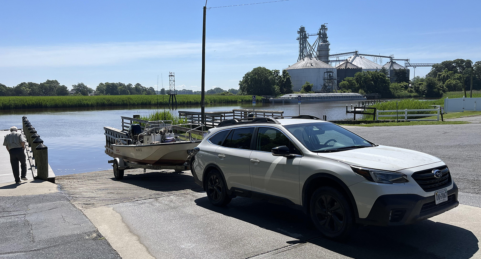
The DWR Boating Access Site at Hoskins Creek.
The power of the Hoskins watershed was obvious in the first of the creek’s dozen meander curves, with a 20-foot-deep hole scoured out at the apex of the bend. We passed through wooded land on the outsides of the curves and broad marshes on the insides. Several landings on the curves reflected various human activities on the lower creek, including the outfall of Tappahannock’s wastewater plant and waterfront houses with docks.
By the third turn, we began to see the Phragmites give way to native big cordgrass, a reflection that the lower creek remains brackish from the salt of incoming Rappahannock tides. Above there, the marshes gradually turned to cattails and then to a tidal fresh mixture of arrow arum, wild rice, smartweed, and other seed-bearing plants that waterfowl love. It was no surprise to see a pair of wood ducks cross the creek, and half-a-dozen strategically located duck blinds spoke of migratory birds in wintertime. A couple of bald eagles and several ospreys on nests confirmed the presence of forage fish like gizzard (mud) shad. We passed an angler in a small bass boat and stopped to talk with another local fishing from shore upstream who spoke of black crappie, several species of bream, chain pickerel, blue catfish, and a few largemouth bass, as well as some large bowfin in the marshes.
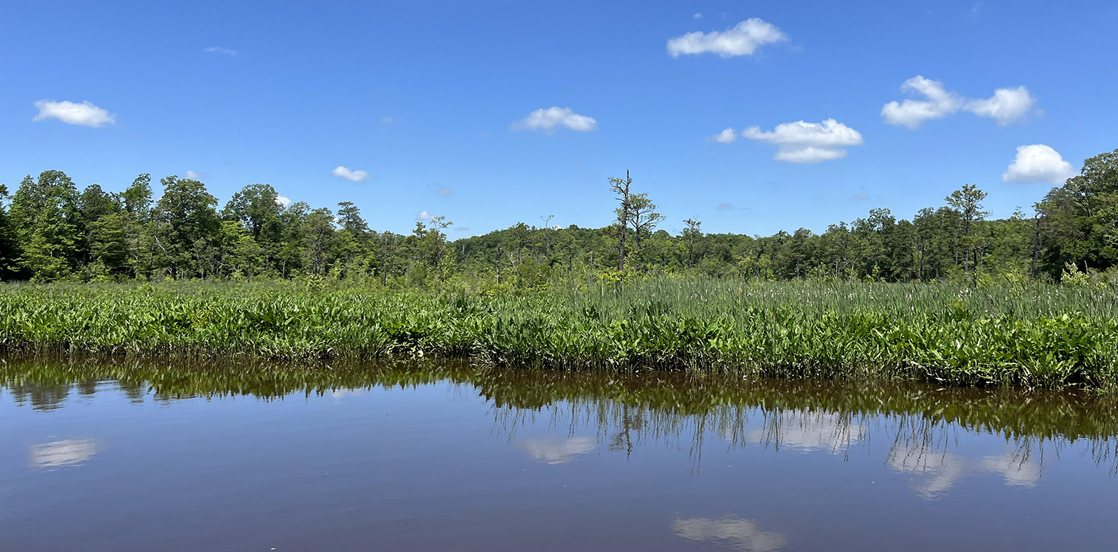
Arrow arum and cattails signal a transition zone in salinity.
Six miles upstream, we ran out of room (width and depth) for the skiff, as well as up against a fallen log blocking our way. The time was noon, the wooded bank offered shade, and a variety of birds sang. Time for lunch. For the duration of a peanut butter sandwich, the Merlin app on my phone registered 14 species, including prothonotary and two other species of warblers, three species of vireo, an orchard oriole, and an indigo bunting.
On the way back downstream, we thought about the history of Hoskins Creek and its surroundings. The Rappahannock people began settling and farming here around 800 years ago, fishing both river and creek, hunting the woods, trapping and foraging the marshes. The first historical reference comes from Captain John Smith, who visited involuntarily early in the winter of 1608 as a captive of the War Chief Opechancanough, brother of the region’s Paramount Chief, Powhatan. The war chief and some of his warriors had captured Smith in the headwaters of the Chickahominy and marched him to Topahanocke, the Rappahannock Chief’s town, to see if he was the European who had killed another Rappahannock Chief several years before.
The latter replied that Smith was too short (5’3″) to have been the same man, so Opechancanough marched him on to Powhatan’s capital, Werowocomoco on the York, where his Virginia adventure continued. Smith told of meeting the Rappahannock Chief again the following summer under first hostile and then more friendly circumstances during his exploration of the entire tidal Rappahannock.
In 1645, Bartholomew Hoskins patented the land around the creek and settled there. Just to the west in 1660, Captain Richard Hobbs patented a large tract just upriver at the mouth of a small creek. There he found a “hole” of deep water close to shore where he could anchor his ship, Elizabeth and Mary, to load tobacco for export to England. Twenty years later, the Virginia General Assembly passed legislation that required construction of warehouses in port settlements. The same year, a surveyor laid out the village’s streets and labeled the harbor Hobbs His Hole, soon elided to Hobbs Hole. Later the village would be called New Plymouth and then in 1705, Tappahannock, an Anglicization of the original Algonkian name meaning “town on the rise and fall of water.”
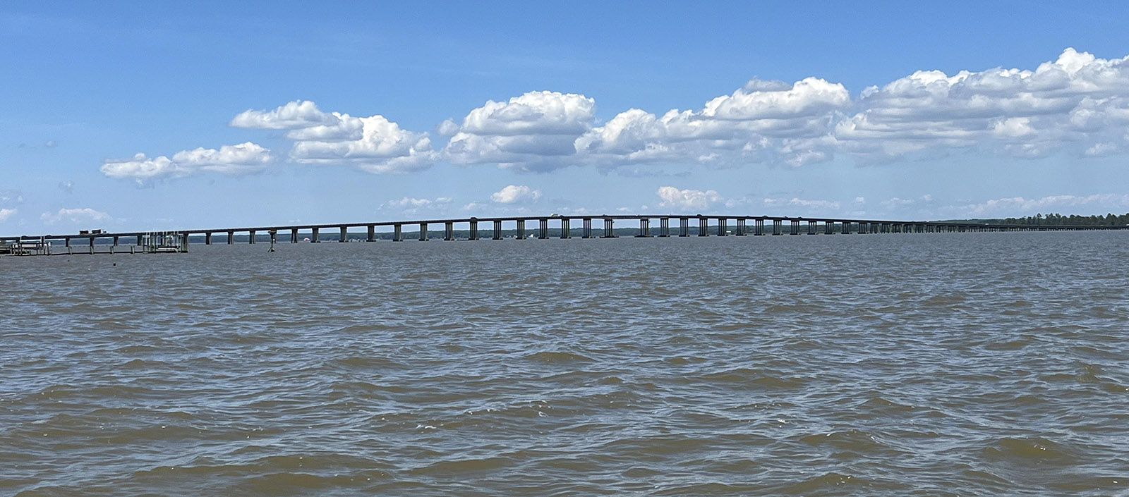
The Route 360 Rappahannock River Bridge is a crucial link for the Northern Neck.
Through the 18th century, Tappahannock prospered as a port, growing along its riverfront and on the ridges of land inside the meanders of Hoskins Creek. Several Scottish merchants established valuable businesses trading grain and natural resources like lumber for manufactured goods with England. By 1786, Tappahannock had become the leading port for the Commonwealth of Virginia in the new United States. From the mid-19th century until the early 1930s, it was an important steamboat landing.
With the advent of good roadways in the 1930s—including Route 17 that runs through the center of town and Rt. 360, which leads to Richmond—Tappahannock has continued to serve the region as a market town and entrance to the upper Northern Neck via the bridge over the river. Hoskins Creek, however, still serves for grain export from the expert farmers of Essex and surrounding counties, though to the Eastern Shore of Maryland rather than England.
After chatting with a retired couple fishing for the Rappahannock’s abundant blue cats from a vintage 1970s fishboat just above the grain terminal, we idled down the creek to get a look at the channel that the towing captains and their crews must navigate to get those laden barges out to the river. It’s tight; their skills are impressive. The channel winds past the piers of a dozen waterfront houses perched on the steep hillside where the creek curves to the east, then turns sharply left at the mouth to follow a narrow, straight channel that cuts through a shoal on the south side of the big river to reach the channel.
From the creek mouth, the Rappahannock offers many more stories. Directly across sits the Island Farm Marsh of the Rappahannock Valley National Wildlife Refuge. Eleven miles upriver lie the spectacular Fones Cliffs (including another segment of the refuge), while just three miles downriver is the mouth of Piscataway Creek, another classic Rappahannock tributary that offers even more meanders and marshes to explore. DWR’s Hoskins Creek landing offers many opportunities to Explore the Wild.
John Page Williams is a noted writer, angler, educator, naturalist, and conservationist. In more than 40 years at the Chesapeake Bay Foundation, Virginia native John Page championed the Bay’s causes and educated countless people about its history and biology.
