
By Ashley Peele
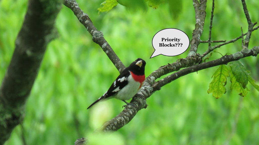
Rose-breasted Grosbeak CO Ashley Peele
Atlas volunteers may have wondered why the Breeding Bird Atlas project focuses primarily on Priority Blocks for breeding bird survey effort. This is a fair thing to wonder about! Some priority blocks are dominated by habitats that birders (and birds!) may deem uninteresting or unsuitable for most breeding bird species. For example, several priority blocks in Fairfax county are primarily urban and suburban habitats with little to no greenspace, while nearby non-priority blocks have nice natural areas or preserves. In more rural Virginia, priority blocks are often comprised of private lands, which can make them difficult to survey off-road. Meanwhile, nearby non-priority blocks are dominated by public lands.
Many Atlas volunteers may have found themselves facing such situations and asking, why do I need to bird here? To answer this question, lets breakdown where the priority block system comes from, provide some historical context, and clarify why it is important for us to survey these areas FIRST. If you’ve attended any of the VABBA2 programs around Virginia, much of this may be review. However, stick with the story, because you might just learn something new.
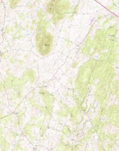
Figure 1. Basic USGS Topo Quad map
First, a brief reminder of what the priority blocks are and how they are distributed. The entire VABBA2 block system is rooted in the USGS Topographic Quadrangle maps, or Quads (Figure 1). These maps are used frequently by backpackers, researchers, foresters, biologists, and anyone else looking for more topographic detail. During the first VA BBA in the mid-1980s, each quad in Virginia was split into six equal blocks and given a two-letter directional (Figure 2). The southeastern-most block in every quad, except those found along state borders, were designated a priority block.
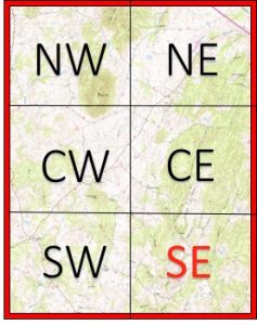
Figure 2. Quad map with Atlas Block labels
Why use this method for VABBA1? First and foremost, because project leaders needed a clean way to spread volunteer effort EVENLY across the state. The best way to achieve this was through an even distribution of blocks rooted in an established mapping system like the USGS Quads.
Why do we still use the same priority blocks in VABBA2? A key objective of this second VA BBA project is to assess how bird species distributions have changed over time. To do this effectively, it is crucial to re-sample the areas of the state with the most historical data and this means targeting priority blocks for survey effort.
It is important to remember that the landscape of Virginia has changed dramatically in the last 30 years. Many blocks that are now dominated by houses and strip malls were fields and woodlands in 1985. Atlas volunteers have the unique opportunity to document HOW these changes have affected local bird communities. The data generated by your efforts are highly valuable for informing everything from State Wildlife Action Plans to bird conservation NGO priorities.
Key takeaway: Atlas priority blocks may not always be the most interesting places to bird, BUT they are the most important survey areas for effectively documenting change in bird species distributions over time. Every priority block that is surveyed thoroughly (see Block Completion Guidelines for more details) fills in one more blank spot on the map of Virginia.
How do I learn more about Atlas priority blocks in my region?
To view a map of all priority blocks in the state, check out the Atlas Block Explorer tool, which can be found via the Atlas website.
To get information on the current data reported to priority blocks, check out eBird’s handy ‘Explore a Region’ tool, which is found on the ‘Explore’ page of the VABBA2 eBird portal (https://ebird.org/atlasva/explore). This tool allows you to summarize data by state, county, or Atlas block. Let’s look at the example of the whole state (Figure 3).
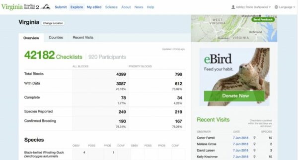
Figure 3. VABBA2 Statewide eBird Summary Page
This is the first screen you will see, which shows a breakdown of the current Atlas project summary statistics. If you then click over from to the Counties page, you will see a list of all counties and independent cities of Virginia. Click on any of these to see a county level summary, e.g. Accomack county (Figure 4).
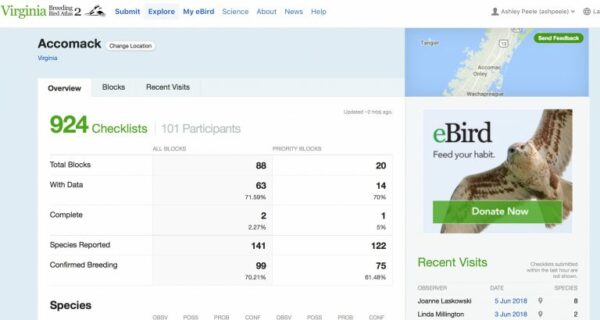
Figure 4. Accomack Summary page – VABBA2 eBird portal
Now, click over to the Blocks page to see the complete lists of blocks in this county (Figure 5). Clicking the Priority button, will change this list to priority blocks only. At this point, volunteers can explore the details of priority blocks in their area. You may be surprised by what you find!
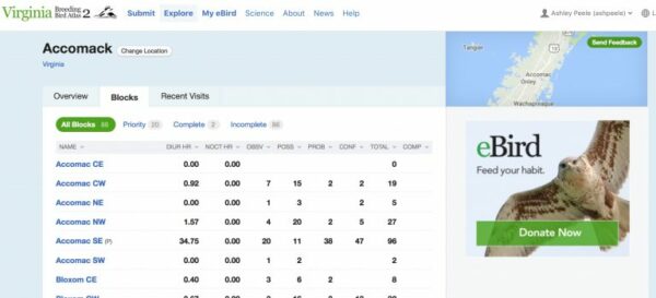
Figure 5. Accomack County Block list – VABBA2 eBird portal
Please explore these tools to both improve your knowledge of the project and to help us meet our goal of significantly increasing the amount of data in statewide priority blocks by the end of this field season.
