
By Eric Wallace
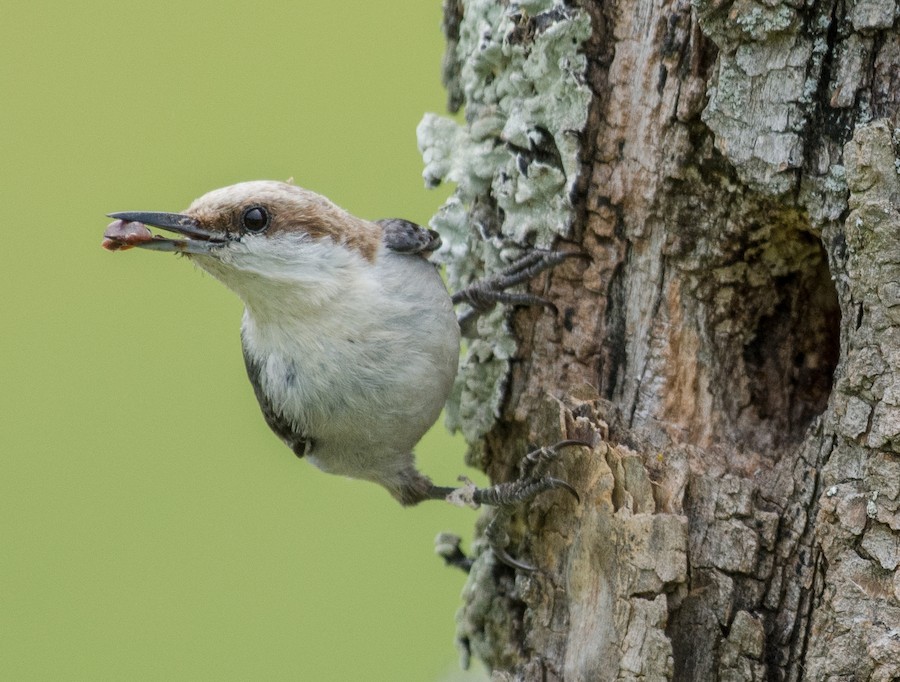
Brown-headed Nuthatch Sitta pusilla © Anne Tucker
The Tobacco Heritage Trail offers great Atlasing opportunities in one of the VABBA2’s most under-birded areas.
To date, VABBA2 volunteers have logged more than 341,000 breeding codes and 3.2 million birds. If you’re one of these valuable contributors, we’d like to take a moment to applaud your efforts—and ask you to help us capitalize on the momentum.
“We’ve had some really great coverage in northern and central Virginia, as well as much of the Tidewater and sporadic areas throughout the state where local bird clubs are based,” says VABBA2 director Ashley Peele, Ph.D. Priority blocks in about 16 counties are at least 75 percent completed. Those in another 17 counties are more than halfway done. With growing participation statewide—and the emergence of groups of traveling blockbusting birders—Peele hopes the success can be replicated in areas like the southern Piedmont, where coverage is lagging behind due to few local residents and fewer local birders.
In counties like Pittsylvania, Halifax, Mecklenburg, Brunswick, and Greensville—think Danville, South Boston, South Hill, Lawrenceville and Emporia—more than 75 percent of priority blocks have yet to be surveyed.
“Achieving even statewide effort is the greatest challenge for any breeding bird Atlas, but it’s also crucial for accurately mapping species’ distributions,” says Peele. An example is the common Barn Swallow. Comparing current data to Virginia’s first Atlas, the species appears to have vanished from much of the southern Piedmont. “Obviously, that’s not the case,” says Peele. “But that’s what the present data would suggest to the casual reviewer.”
Regional blind spots exist for other birds as well. These include species like Dicksissel, Bobolink, Red-headed Woodpecker, Brown-headed Nuthatch, Blue Grosbeak, Great Crested Flycatcher, Prothonotary Warbler, and more.
Interested in helping close the gap? The Tobacco Heritage Trail offers readymade birding opportunities near and within some of the southern Piedmont’s highest priority blocks. Open to the public, the rail-to-trail system is paved with crushed rock and mostly flat. It provides miles of easy viewing through habitats ranging from grassy meadows, agricultural fields and pastures, river and creekside riparian environments, hardwood and pine forests, rural communities, and more.
“The most challenging thing about Atlasing in this region is that most of the land is private,” says Peele. For traveling birders, the Trail can streamline planning and maximize hours spent surveying. Passing through a chain of interesting historical villages and towns, it provides cultural opportunities as well. Better still, campgrounds are close at hand.
Below is our go-to guide for making the best of a blockbusting adventure.
And don’t forget that space is still available on our Atlas Blockbusting rallies in the southern Piedmont! For more info, see the Atlas Events page.
THE TRAIL
Lawrenceville to Evans Creek Road Access, 8 miles — The trailhead is located by a small gravel lot off of South Street in downtown Lawrenceville. The first mile or so cuts through the town along grassy, tree-lined corridors past clusters of homes and a handful of industrial buildings. Crossing Brickyard Street, users enter an isolated 7-mile stretch, passing through fields, meadows, and forests in the heart of Brunswick County. Along the way, enjoy three trestle bridges crossing Great Creek, as well as a 300-foot-long walking bridge atop historic pylons spanning the Meherrin River.
Evans Creek to Brodnax, 4.8 miles — From the parking lot off Evans Creek Road (Route 623), you’ll proceed through an uninterrupted stretch of dense forests studded with occasional grassy clearings. The path parallels Evans Creek for about 3 miles, with swampy areas interspersed. A rest stop with picnic tables is located about a mile west of the trailhead.
Brodnax to La Crosse, 3.1 miles —Approaching the 300-person historical railroad village of Brodnax, the trail traverses a large span of farmland before passing under U.S. 58 and merging with Railroad Street. Follow the paved lane through this rural community for about 1.2 miles—being sure to look for the old Broadnax Depot on your left—before the trail returns to a nonmotorized route. (Parking is available at the reentry point.) From there, it’s 3.1 miles to La Crosse. The asphalt trail passes the Mecklenburg-Brunswick Regional Airport and brings alternating pine forests and farmland.
La Crosse to South Hill, 1 mile —From the Caboose park near the town offices, follow the trail through rural neighborhoods and woodlands for one mile to the edge of the South Hill town limits. The route terminates at the intersection with Rocky Branch Road, about 3.4 miles from downtown South Hill. There, you’ll find the fantastic Tobacco Farm Life Museum of Virginia and the lovely Centennial Park.
EAT / DRINK
Kahill’s Restaurant and Pub, South Hill —About a mile from the South Hill terminus, Kahill’s offers clay-oven pizzas, upscale surf-n-turf, and burgers, in a casual fine-dining setting. Their full-service bar keeps nine Virginia craft beers on tap, and features selections from the nearest wineries and distilleries. www.kahillsrestaurantandpub.com
For further information about camping, amenities, and where to best apply your Atlasing efforts, refer to the atlas contact page.
