
In my article “Photo Tips: Photographing the Night Sky” in the May/June 2020 issue of Virginia Wildlife magazine, I discussed some of the basic strategies for photographing the night sky. Here, I’ll dive a bit deeper into some of the technical aspects and techniques.
Carefully planning your photo shoot ahead of time can make all the difference when it comes to night sky landscape photography. The resources listed here are some that I’ve used to help make the most of my time in the field. While most of these tools are available for free, a few resources mentioned are paid apps or services. While I have used these tools personally, their inclusion here is not an endorsement by the Department of Wildlife Resources (DWR).
Location Scouting
- Google Earth (Web)
Google Earth’s 3D view can be an invaluable tool for getting a rough idea of the landscape and views before you drive to a location. Best of all, Google Earth is free!
Planning Your Compositions
- Photo Pills (iOS/Android)
- The Photographer’s Ephemeris (TPE) (iOS/Android/Web)
Both Photo Pills and TPE are apps available for your smartphone that will assist in planning compositions once you’re at a location. Using either of these apps, you can see exactly how the Sun, Moon, or Milky Way will appear at your location at any time, allowing you to plan your shot and create unique and powerful compositions using foreground elements and the celestial object of interest. Both apps are available from the Apple or Google’s app stores.
How to Find a Site Away from Light Pollution
While you can easily photograph certain objects, like the Moon or planets, from an urban or suburban location with light pollution, finding a site with relatively dark skies is important when photographing the Milky Way and meteor showers.
- International Dark Sky Association’s “Find a Dark Sky Place” Map: IDA’s map only includes their designated dark sky sites, but it’s a good place to start, in part because these sites have met certain criteria to receive the designation.
- Dark Site Finder
- Light Pollution Map
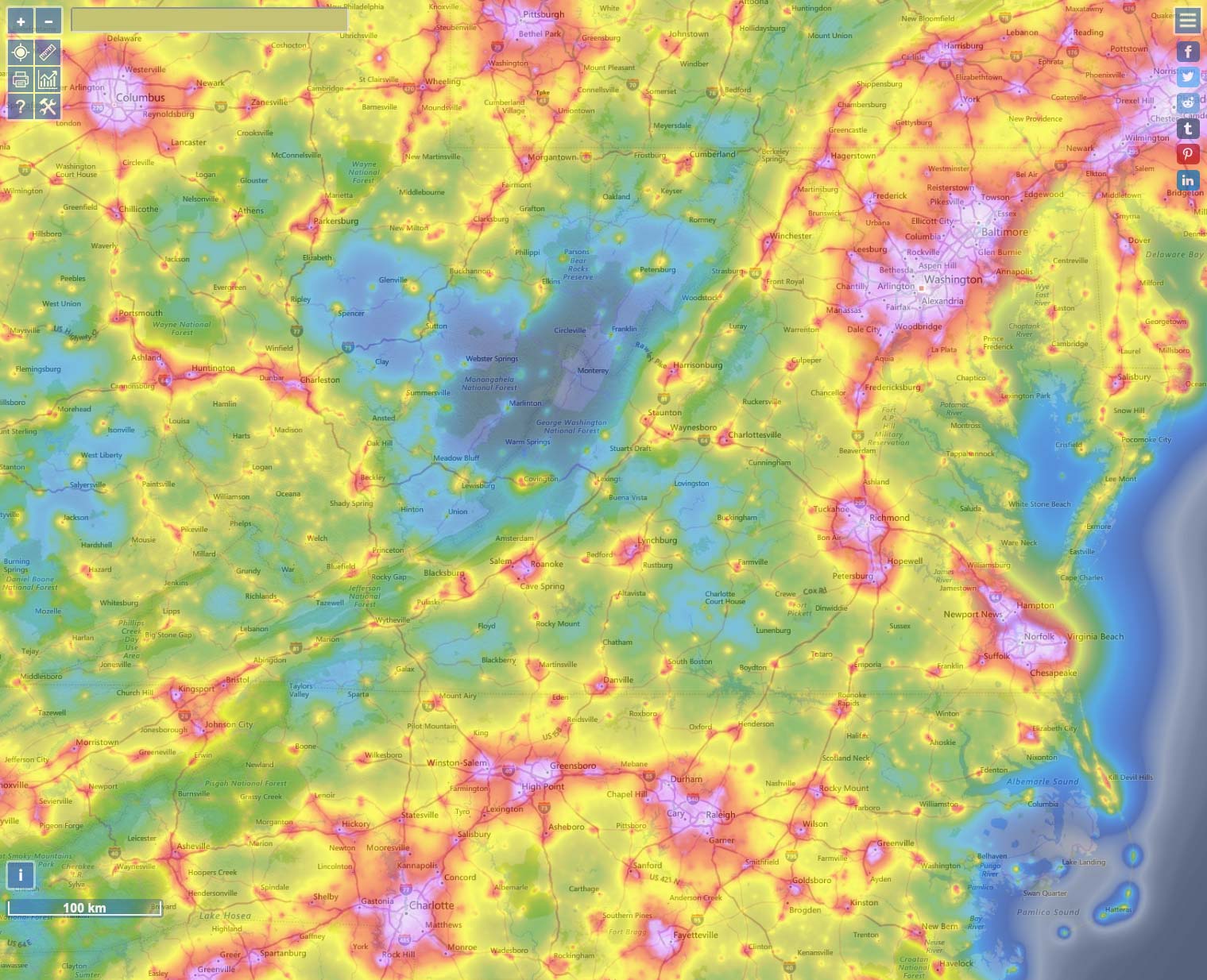
Light pollution in and around Virginia as visualized by LightPollutionMap.info. Areas with a higher density of people and artificial lighting are displayed in white, pink, red, and yellow. More rural areas with fewer artificial lights are generally green, blue, or dark grey. These locations will be your best bets for observing and photographing the Milky Way.
Weather Forecasts
- Clear Sky Charts (Web/iOS)
The Clear Sky Charts website provides graphical weather forecast charts for specific locations around North America, giving an at-a-glance view of predicted weather conditions, including the hour-by-hour amount of cloud cover and darkness. Although paying attention to the usual weather forecasts is advisable, the Clear Sky Charts offer more granular predictions of factors that are especially important to astronomical observations. The map view of available forecast locations also includes a handy light pollution overlay, so you can more easily find a site and see the upcoming weather for that area.
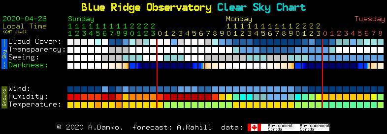
An example forecast from the Clear Sky Chart website.
Post-Processing
Straight out of the camera, night sky images often appear somewhat low-contrast and relatively unimpressive, compared to many of the photos you’ve likely seen online. The reason for that is that a significant part of nightscape photography lies in post-processing that helps bring out all of the rich detail contained in the RAW file.
While techniques for post-processing can vary according to a photographer’s preferences and the software tools used, the Lonely Speck website and the video below both contain useful information to get started with this important aspect of night sky photography.
Learn More About Night Sky Photography Techniques
To learn more about the basics of photographing night sky landscapes, check out this Photos Tips article from the May–June 2020 issue of Virginia Wildlife magazine.
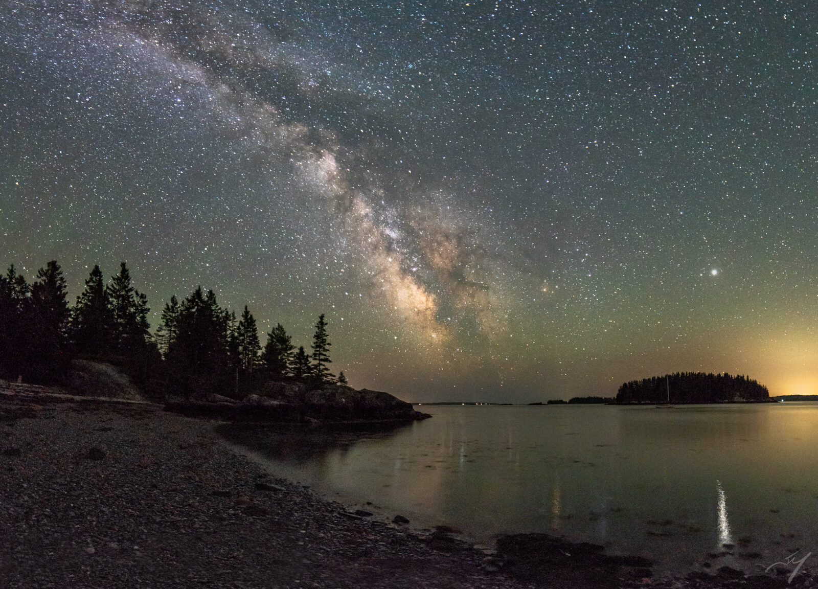
The Milky Way rises over the Penobscot Bay in Maine.