
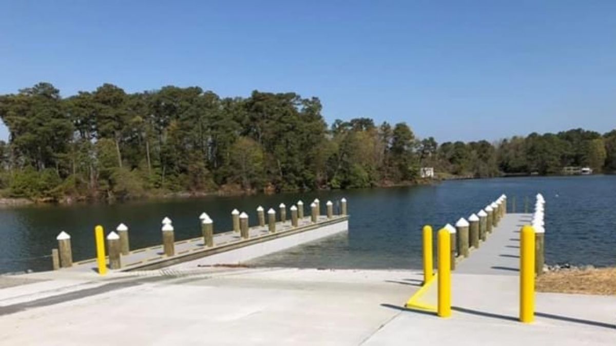
DWR's Shell Landing on Cockerell Creek offers great access to a number of scenic and fishing destinations.
By John Page Williams
What’s your boating pleasure? Paddling a kayak or canoe up a tidal creek to visit a historic town’s museum and grab lunch at a waterside seafood restaurant? Sailing a small boat up a lovely tidal river full of interesting coves? Fishing marsh banks and restoration oyster reefs from a skiff? Or venturing out into the open Chesapeake in a larger boat to visit Tangier Island or fish the channel edges of Tangier Bar?
Shell Landing on the Northern Neck’s Cockrell Creek is your access ticket. This double concrete ramp is located between Reedville and Fleeton, just off Rt. 657.
To paddle to Reedville, follow the Cockrell Creek Water Trail. Be careful venturing out, keeping a sharp lookout for large workboats and light airplanes overhead taking off or landing on your right as you pass Reedville’s airport. The planes are likely menhaden fish spotters for the Omega Protein fleet of large purse seine vessels, which you’ll pass as you venture into the creek’s main stem. Also on your right will be the “fish factory,” the Omega Protein industrial plant that renders the catch of menhaden into omega-3 oil diet supplements, fishmeal for aquaculture, and other products.
The text of the Water Trail’s maps will introduce you to the history of menhaden fishing in Reedville. You‘ll also pass “The Stack,” a landmark left from a former fish factory. From The Stack, paddle northeast and then northwest in a gentle curve to Reed’s Point, the foot of Reedville’s main street (and the eastern end of U.S. Route 360). There you’ll find The Crazy Crab, a great place to stop for lunch. Distance so far is 1.75 miles.
After lunch, head up Cockrell Creek, keeping Reedville to starboard, for three-quarters of a mile to the Reedville Fishermen’s Museum. There you’ll get the full story of the 150-year-old town built around all types of commercial fishing and boatbuilding. Just make sure you allow time for your 2.5-mile paddle back to Shell Landing.
Got a trailerable sailboat or outboard skiff and want to explore a lovely tidal river with lots of creeks? Shell Landing is your ticket to the Great Wicomico, a 9-mile-long tributary of the Chesapeake that includes 10 navigable creeks and a mainstem wide enough to offer good breezes for small boat sailing.
If a skiff is your preference, it’s equipped with fishfinder and pushpole, and you like to fish with light tackle, the Great Wicomico offers both restoration oyster reefs and, at the southern side of its mouth, the Dameron Marsh Natural Area Preserve, owned and managed by Virginia’s Department of Conservation and Recreation (DCR). Multiple partners, including the Chesapeake Bay Foundation and The Nature Conservancy’s Virginia Office have assisted the Virginia Marine Resources Commission (VMRC) in building and stocking the reefs in the area upriver of Sandy Point, in a broad cove where current eddies naturally concentrate oyster larvae, creating ideal conditions for growth.
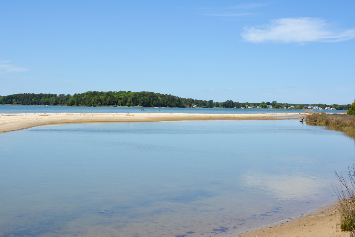
The Dameron Marsh Nature Preserve
One of the restoration reefs, built by the VMRC, is marked as a hazard to navigation because it is shallow enough to break the surface at low tide. It is excellent habitat for rockfish (striped bass), white perch, spot, croakers, speckled trout, and puppy (red) drum. Much of the other bottom in that part of the river is leased to watermen for oyster aquaculture, and that shell bottom too attracts fish. Finally, rockfish, specks, and puppy drum all frequent the underwater grass beds around Dameron Marsh. You can get an idea of these habitats from this VMRC Chesapeake Bay Map.
Finally, if your boat is large enough and the weather is fit, Shell Landing is a great launch point for the 16-mile run to visit Tangier Island. The web site offers information on where to tie up (Parks Marina), where to eat island seafood, how to tour the town, and especially when to visit the museum. Tangier is a special place, full of friendly people who work hard to draw their living from the Chesapeake Bay.
If you want to fish these broad open waters, there’s plenty of opportunity here as well. The route from Shell Landing to Tangier crosses the Bay’s deep main channel, carved thousands of years ago by the Susquehanna River. It is literally the interstate highway for every fish that swims up and down the Chesapeake.
On the east side of the channel, the broad, triangular Tangier Bar extends south from the island for 14 miles to join the channel coming down from Tangier Sound to the east. One of the classic spots to jig or troll the edge of the bar is around channel buoy #62, at its western edge. Other good spots include—but aren’t limited to—the edges around red nun buoy #2 on the interior of the bar and several wrecks closer to the island. (The latter hold plenty of fish in season, but be very careful navigating around their jagged remains.) The waters outside the Great Wicomico also offer two of VMRC’s artificial reefs, the Northern Neck Reef and the Asphalt Pile. There’s more in these wide waters, but these suggestions will get you started.
Shell Landing? It would take a lifetime to explore all of the possibilities this public access facility offers. What are you waiting for? Get started.
Want more articles about boating and paddling in Virginia? Sign up for our monthly Boating email newsletter!
John Page Williams is a noted writer, angler, educator, naturalist, and conservationist. In more than 40 years at the Chesapeake Bay Foundation, Virginia native John Page championed the Bay’s causes and educated countless people about its history and biology.
