
Description
Elevation: 3229 ft.
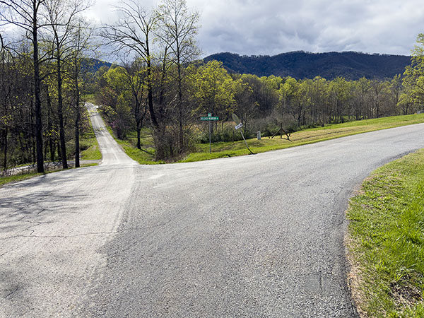
Belcher Mountain Road is a driving route that takes the traveler past farmhouses and through the fields and forests of Virginia’s Blue Ridge. The road includes views of several small ponds as well as higher elevation fields around 3000 ft. For most of its 7.3-mile length, the road passes through deciduous woodlands and is an excellent place to search for woodland bird species.
Birds along this trail vary between the seasons with the highest variety occurring during migration. Breeding species in the area include downy woodpecker, northern flicker, eastern phoebe, eastern kingbird, blue-gray gnatcatcher, eastern bluebird, wood thrush, brown thrasher, cedar waxwing, red-eyed vireo, indigo bunting, eastern towhee, chipping, field and song sparrows, red-winged blackbird, and eastern meadowlark. A variety of warblers and both savannah and grasshopper sparrows have also been reported during the summer. The more open areas along the roads provide ideal opportunities to spot white-tailed deer although these are often seen crossing the road. The road margins support a good diversity of wildflowers with chicory, crown vetch, black-eyed Susans and Queen Anne’s lace. In turn, these wildflowers attract numerous butterflies. Swallowtails being especially abundant provide visitors a chance to admire the subtle differences between pipevine, spicebush, black and the black form of eastern tiger swallowtail.
Notes:
- Most of Belcher Mountain Road is unpaved and rough. 4WD/AWD vehicles with high clearance are strongly recommended.
Wildlife Sightings
species have been reported at this site to date.
Birds Recently Seen at Belcher Mountain Road:
Recent Checklists:
| Date | # of Species | Submitted By |
|---|---|---|
| 14 Jun 2022 | 10 | Ed Coleman |
| 21 Jul 2021 | 3 | Ed Coleman |
| 24 Jul 2020 | 2 | Ed Coleman |
| 27 Oct 2014 | 14 | Tom Davis |
| 28 Feb 2014 | 7 | Tom Davis |
Amenities & Accessibility
Amenities
Other Amenities: Wildlife Viewing by Car
Accessibility Considerations
This location does not have a Birdability Site Review available at this time
Learn more about Birdability’s efforts to map accessible outdoor spaces
Maps & Directions
Starting Point Coordinates: 36.765169, -80.301548
From Floyd, head south on VA-8/S. Locust St, sharp right onto SR-616/Mill House Rd, turn right to stay on SR-616/Mill House Rd, and the starting point will be on the right in approximately 0.6 miles.
Site Information
Access Requirements:
- Free, Daily
Contact Information:
- Patrick County Chamber of Commerce: 276-693-2005
- Visit Website
Sites, or portions of sites, can be closed periodically for management activities. Please always check the site’s website for additional information prior to visiting.