
Description
The Rexrena Boating Access Site can be found at the junction of Copper Creek and the Clinch River in Scott County. The property is approximately 2.5 miles downstream from a DWR access point at Clinchport and 9.5 miles upstream of the DWR access site at the Tennessee state line. Visitors who choose to navigate to either destination are sure to be treated to a variety of wildlife sightings as they paddle or float this particularly beautiful stretch of the Clinch River. In many areas, the banks hold the tangled branches of downed trees which provide habitat for queen and Northern water snakes, as well as Northern map turtles and Eastern spiny softshell turtles. The higher branches provide the perfect vantage point for a belted kingfisher to survey for the next meal, while the lower branches support green heron ready to pick fingerlings from just below the surface.
Notes:
This property is enrolled in the DWR’s Public Opportunities for Wildlife-Related Recreation (POWRR) program which provides public access for a variety of wildlife-related recreation through lease agreements on private property. Birding, photography and general wildlife viewing is permissible without the need to posses a license, permit, or Restore the Wild membership. A map of POWRR properties and site boundaries can be found here. Please respect the respective property boundaries and any observed no trespassing signs on site.
Other allowable activities on site include: fishing and boating with the appropriate license and registration. Dogs are allowed but must remain on a leash and all waste must be picked up. Prohibited Activities include: Hunting, trapping, open air fires, possession, consumption and public display of alcoholic beverages, camping, littering and ATV riding.
Wildlife Sightings
40 species have been reported at this site to date.
Birds Recently Seen at DWR POWRR Property – Rexrena Boating Access Site:
Recent Checklists:
| Date | # of Species | Submitted By |
|---|---|---|
| 8 Jun 2026 | 2 | Moses J. Michelsohn |
| 12 Nov 2025 | 3 | Brabble Hoffman |
| 12 Nov 2025 | 3 | Mark S. Hoffman |
| 23 Oct 2025 | 9 | Robert Riggs |
| 23 Oct 2025 | 9 | Elaine Sharpe |
Amenities & Accessibility
Amenities
- On-site Parking
- Kayak/Canoe Launch
- Boat Ramp
Accessibility Considerations
This location does not have a Birdability Site Review available at this time
Learn more about Birdability’s efforts to map accessible outdoor spaces
Maps & Directions
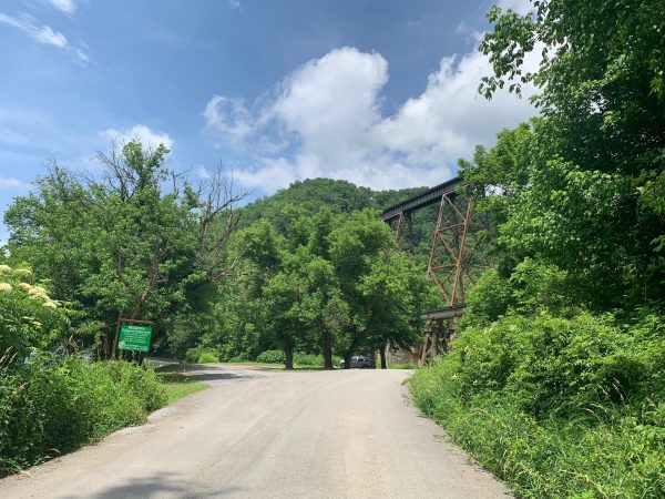
From Gate City, head west along US-23 N/US-421 N/US-58 W. After traveling approximately 8 miles west of Gale City, turn right onto Copper Creek Rd (VA-627 E); the site is located approximately .6 miles down the road with a parking area and sign visible on the left hand side.
Site Information
Managed By:
- VA Dept. of Wildlife Resources
Access Requirements:
- Free, Open daily from dawn to dusk
Contact Information:
- VA Dept of Wildlife Resources Region 3 Office: 276-783-4860
- Visit Website
Sites, or portions of sites, can be closed periodically for management activities. Please always check the site’s website for additional information prior to visiting.