Description
Elevation: 2565 ft.
The Peaks of Otter is formed by the triangulation of three mountains: Sharp Top Mountain, with a summit of 3875 feet; Flat Top Mountain, whose peak is at 4001 feet; and Harkening Hill, whose apex reaches 3372 feet. Nestled between these mountains is Abbott Lake. Seven trails meander throughout this recreational area, traversing old-growth hardwood forests, open meadows, rocky outcrops, a cascading waterfall, streamside woodlands, and lake habitats.

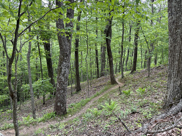
The Harkening Hill Loop Trail goes through cerulean warbler breeding habitat. Photo Credit: Lisa Mease/DWR
Birders will, perhaps, find the best birding on the Flat Top Mountain Trail, where high-elevation neotropical songbirds nest. In the summer, look for black-throated blue, cerulean, Blackburnian, worm-eating, and Canada warblers, as well as blue-headed vireo, scarlet tanager, and rose-breasted grosbeak. The woodlands resonate with the melodies of veery and the chipping of dark-eyed junco. Spring and fall can produce a large number of migrants. Migratory passerines may be found in the woodlands, raptors soaring above, and common loon and other waterfowl and shorebirds taking refuge in Abbott Lake. Other wildlife, including white-tailed deer, wild turkey, red fox, and even black bear inhabit this large recreation area. Herp lovers will be enthused to find timber rattlesnake, American toad, and five-lined skink lurking along the trails along with a variety of salamanders. In addition to the hiking trails, this site offers lodging facilities, picnic shelters, a restaurant, and a visitor’s center with wildlife displays and a gift shop.
Wildlife Sightings
179 species have been reported at this site to date.
Birds Recently Seen at Peaks of Otter Recreation Area:
Recent Checklists:
| Date | # of Species | Submitted By |
|---|---|---|
| 4 Dec 2025 | 2 | Bob Epperson |
| 24 Oct 2025 | 14 | Antoinette Pepin |
| 20 Oct 2025 | 35 | John Pancake |
| 20 Oct 2025 | 35 | Bob Epperson |
| 15 Oct 2025 | 32 | Bob Epperson |
Amenities & Accessibility
Amenities
- On-site Parking
- Restrooms
Other Amenities: Camping/Lodging, Hiking Trails, Interpretive Program/Events, Visitor/Nature Center, Wildlife Viewing by Car, Historical Site
Accessibility Considerations
Learn more about Birdability’s efforts to map accessible outdoor spaces
Maps & Directions
Physical Location: Milepost 85.6 on the Blue Ridge Parkway
Visitor Center Coordinates: 37.445300, -79.609760
From Bedford, VA, take State Rt 640 for 2.8 miles, then turn left onto State Rt. 643 and continue 0.7 miles. Turn right onto VA-43 N and travel 5 miles to the Blue Ridge Parkway. Turn right onto the parkway. Travel 0.4 miles to the Recreation Area, which will be on the left.
Site Information
Access Requirements:
- Free, Daily
Contact Information:
- Tom Davis, g_tom_davis@nps.gov
- Visit Website
Sites, or portions of sites, can be closed periodically for management activities. Please always check the site’s website for additional information prior to visiting.


