
Description
Elevation: 2304 ft.
This natural area preserve encompasses over 1400 acres of woodland community. As its name implies, the soil of this area is predominantly infertile. Poor Mountain has over 4 miles of hiking trails wandering through pine-oak woodlands, with an understory comprised of huckleberry, mountain laurel, and lowbush blueberry. Resident Pileated Woodpeckers dart across the woods vocalizing in flight. Wood Thrush, Scarlet Tanager, and Ovenbird are apparent neotropical nesters easily spied in the breeding season. Unique to this area is the world’s largest known population of piratebush, a light-colored, hemi-parasitic shrub. Considered to be state imperiled and globally vulnerable, this is one of the rarest shrubs in eastern North America and is only found at a few locations in Virginia, Tennessee, and North Carolina.
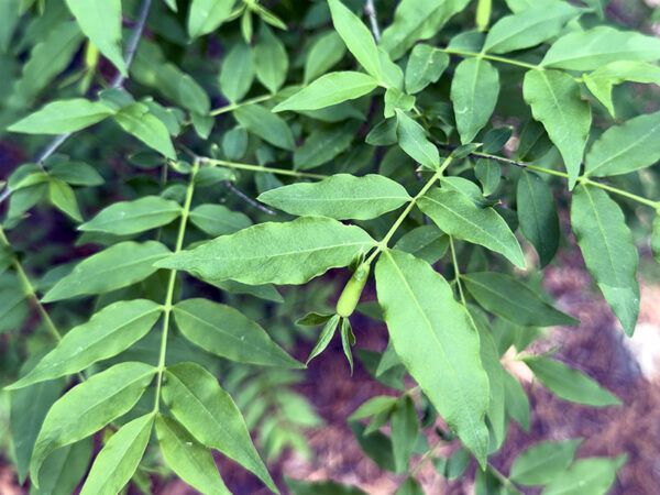
Piratebush in late May. Photo Credit: Lisa Mease/DWR
White-tailed deer, black bear, and eastern gray squirrel scurry throughout this preserve. Common wood-nymph and Appalachian brown skirt along woodland edges, while pipevine swallowtail and great spangled fritillary flit about the blooming milkweeds near the parking lot.
Wildlife Sightings
119 species have been reported at this site to date.
Birds Recently Seen at Poor Mountain Natural Area Preserve:
- Red-bellied Woodpecker
- Downy Woodpecker
- Northern Flicker
- Eastern Wood-Pewee
- Acadian Flycatcher
- Blue-headed Vireo
- Red-eyed Vireo
- American Crow
- Common Raven
- Carolina Chickadee
Recent Checklists:
| Date | # of Species | Submitted By |
|---|---|---|
| 19 Jul 2026 | 17 | Kent Skaggs |
| 6 Jul 2026 | 9 | Nancy Stafford |
| 15 Jun 2026 | 6 | L. Houston |
| 14 Jun 2026 | 8 | Seth Davis |
| 14 Jun 2026 | 8 | Anonymous eBirder |
Amenities & Accessibility
Amenities
- On-site Parking
- Birdability Report Available
Other Amenities: Hiking Trails
Accessibility Considerations
This location has a Birdability Site Review available
Learn more about Birdability’s efforts to map accessible outdoor spaces
Maps & Directions
Parking area GPS Coordinates: 37.228817, -80.088648
From Roanoke, head south on US-221/Brambleton Ave SW, turn right onto SR-694/Twelve Oclock Knob Rd, and the parking area will be on the left in approximately 3.7 miles.
Site Information
Access Requirements:
- Free, Daily
Contact Information:
- Phone: 540-265-5234
- Email: Ryan.Klopf@dcr.virginia.gov
- Visit Website
Sites, or portions of sites, can be closed periodically for management activities. Please always check the site’s website for additional information prior to visiting.