
Description
Elevation: 2413 ft.
The Cove is a sparsely populated farming community situated in Tazewell County and is one of the last remaining valleys expressly devoted to agriculture. This driving route begins at the intersection of VA-91 N/Maiden Springs Rd. and SR-608/Cove Rd., and follows Cove Rd. for approximately 5.8 miles to where the paved road ends.
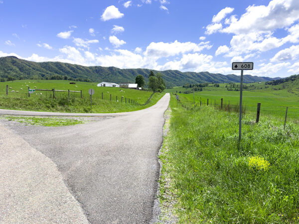
The starting point for The Cove driving route. Photo Credit: Lisa Mease/DWR
Grassland and open field birds are abundant with large flocks of Red-winged Blackbird, Eastern Meadowlark, Eastern Bluebird, Barn Swallow, and American Goldfinch in residence. The Cove is also one of the better locations in Virginia to see Loggerhead Shrikes. American Kestrel, Bald Eagle, Great Blue Heron, and Wild Turkey make their home here. The open grasslands are also excellent habitat for Grasshopper Sparrow during the breeding season and Bobolink in summer. Black bear, white-tailed deer, and red fox are among the valley’s wildlife. In winter, look for patrolling Northern Harriers and Golden Eagles.
Notes:
- Cell service is very unreliable in this area. Please have alternate means of navigating.
- The land on either side of Cove Rd is private property. Please be respectful of property lines if pulling off the road.
Wildlife Sightings
157 species have been reported at this site to date.
Birds Recently Seen at The Cove, Tazewell County:
- Turkey Vulture
- Belted Kingfisher
- Northern Flicker
- American Crow
- Gray Catbird
- Eastern Towhee
- Brown-headed Cowbird
- Indigo Bunting
Recent Checklists:
| Date | # of Species | Submitted By |
|---|---|---|
| 6 Jul 2026 | 8 | Adit Nehra |
| 25 May 2026 | 22 | Clancey Deel |
| 4 Apr 2026 | 22 | Clancey Deel |
| 8 Mar 2026 | 3 | Clancey Deel |
| 8 Mar 2026 | 8 | Clancey Deel |
Amenities & Accessibility
Amenities
Other Amenities: Wildlife Viewing by Car
Accessibility Considerations
This location does not have a Birdability Site Review available at this time
Learn more about Birdability’s efforts to map accessible outdoor spaces
Maps & Directions
GPS Coordinates of Starting Point: 37.015071, -81.673293
From Marion, head south on 1-81, take exit 35 and turn right onto VA-107 N/Whitetop Rd, turn right onto CR-773/CR-610/Valley Rd, turn left onto CR-723/Possum Hollow Rd, slight left to continue on CR-633/Possum Hollow Rd, turn right onto VA-91 N/Saltville Hwy, in approximately 2.3 miles, turn left to stay on VA-91 N/Veterans Rd, in approximately 8 miles make a sharp left to stay on VA-91 N/Clinch Mountain Rd, and the starting point is at the intersection of VA-91 N/Maiden Springs Rd and SR-608/Cove Rd in approximately 12.8 miles.
Site Information
Access Requirements:
- Free, Daily
Contact Information:
- Daryl Owens, darylowens@hotmail.com
- Visit Website
Sites, or portions of sites, can be closed periodically for management activities. Please always check the site’s website for additional information prior to visiting.