
Fact File
Scientific Name: Graptemys geographica
Classification: Reptilia, Order Testudines, Family Emydidae
Conservation Status:
- Species of Greatest Conservation Need-Tier 4a on the Virginia Wildlife Action Plan
Size: Up to 9.75 inches in length
Identifying Characteristics
This is a large freshwater turtle reaching a maximum carapace length of about 10 inches. This species has a broad jaw surface, a spot on the side of the large head of the female, and a low and flattened carapace with a central keel that may or may not be elevated to form a tubercle. The carapace is brown to olive with a pattern of fine, yellow reticulations. Juveniles are colored and patterned as adults, except that the carapace is rounded for the first 1-2 years of life. Mating occurs from May to July and sometimes again in the fall. Nesting is done in soft soil or sand always in full sunlight, with 10-16 eggs being laid. Eggs hatch in August and September.
Habitat
This turtle is primarily nocturnal, remaining asleep in the sunshine most of the day. It is reluctant to hibernate and has been known to be caught on the beach after the lake freezes over. It is usually active from April to September throughout its range. This turtle is extremely gregarious, sometimes piling 4 deep. Map turtles are wary baskers and will dive off basking sites at the least disturbance. Large turtles will often physically displace smaller ones at the most used basking sites and large ones will bask further away from shore than small ones. It is seldom seen on land. It hibernates under slow water, beneath rocks or ledges.
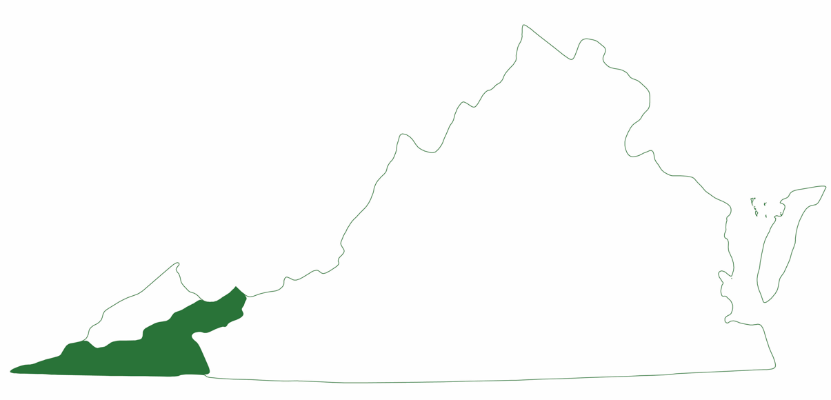
Distribution:
The map turtle is found in the upper Tennessee drainage system, including the Clinch, Powell, and Holston rivers and their tributaries, in southwestern Virginia. This species inhabits the pools and riffles of rivers and creeks. Areas with large sandy or grassy beaches are favored.
Did you know?
All 10 species of map turtle occur in the United States.
Last updated: July 18, 2024
The Virginia Department of Wildlife Resources Species Profile Database serves as a repository of information for Virginia’s fish and wildlife species. The database is managed and curated by the Wildlife Information and Environmental Services (WIES) program. Species profile data, distribution information, and photography is generated by the Virginia Department of Wildlife Resources, State and Federal agencies, Collection Permittees, and other trusted partners. This product is not suitable for legal, engineering, or surveying use. The Virginia Department of Wildlife Resources does not accept responsibility for any missing data, inaccuracies, or other errors which may exist. In accordance with the terms of service for this product, you agree to this disclaimer.