
- Background Information
- TNC/Chesapeake Bay Fish Passage Prioritization Tool
- Project Approach
- Completed Fish Passage Projects in Virginia
- James Drainage
- Manchester and Brown’s Island Dam Breaches – 1989
- Belle Isle Dam Natural Breach
- Williams Island Dam Notch – 1993
- Bosher’s Dam Vertical Slot Fishway – 1999
- Woolen Mills Dam Removal – 2007
- Quinn Dam Removal – 2007
- Harrison Lake Denil Fishway – 1989
- Walkers Dam Double Denil Fishway – 1989
- Harvell Dam Denil Fishway – 1998
- Harvell Dam Removal – 2014
- Abutment Dam Denil Fishway – 2003
- Brasfield Dam Fish Lift – 2004
- Baber’s Mill Dam Removal – 2024
- Rappahannock Drainage
- Potomac Drainage
- James Drainage
- Potential Fish Passage Projects in Virginia
Background Information
Throughout their ranges on the East Coast of the United States, migratory fish stocks are on the decline. Like many other East Coast states, Virginia was once known for its high quality spring runs of anadromous fishes. During the Colonial Period colonists relied heavily, as did Native Peoples, on the abundant stocks of shad and herring that migrated deep into the heart of the state. Evidence indicates that American shad were fished near the headwaters of the James River, hundreds of river miles from the Chesapeake Bay. The historical record also indicates that shad and herring routinely migrated through the fall zone and into the upper reaches of all major drainages in Virginia. Throughout the 1800’s, the harvest of shad and presumably herring increased dramatically throughout Virginia. The number of dams and other impediments also increased throughout the state to provide waterpower for a growing agricultural and industrial base, and to support an expanding canal system. By the early 1900’s, heavy fishing pressure and loss of spawning and rearing habitat began to impact shad populations and, to some extent, herring stocks. During the middle of the 20th Century there was a surge of fishing effort, and thus harvest, just prior to a steady decline that began in the 1970s. By 1990 only 450,000 pounds of shad was harvested in Virginia, a mere fraction of the eight million pounds at the turn of the century (19th to 20th).
The importance of migratory fish species was recognized in the 1987 Chesapeake Bay Agreement and re-affirmed in Chesapeake 2000. A commitment was endorsed to “provide for fish passage at dams and remove stream blockages whenever necessary to restore natural passage for migratory and resident fish.” The Fish Passage Work Group of the Bay Program’s Living Resource Subcommittee developed strategies (1988) and implemented plans (1989) to fulfill this commitment. In 2004, the original Fish Passage Goal of 1,357 miles (established in 1987) was exceeded. Chesapeake 2000 led to the establishment of a new Fish Passage Goal, set in 2004, committing signatory jurisdictions to the completion of 100 fish passage/dam removal projects, which will re-open 1,000 miles of high-quality habitat to migratory and resident fishes. Virginia will be responsible for roughly 1/3 of the miles to be reopened. This increased the overall goal to 2,807 total miles. In 2007, the partners reopened 122 additional miles (54.7 in VA). This brought the total miles reopened to date to 2,288, which is 81% of the total goal. The fish passage partners are well on the way to achieving the new goal.
Project Approach
The Virginia Department of Wildlife Resources (DWR) is using a state matched EPA Chesapeake Bay Program grant to fulfill the 1989 Implementation Plan initiatives for removing impediments to migratory fishes and restoring depleted migratory fish stocks in the Chesapeake Bay watershed. This includes employing a Fish Passage Coordinator whose job it is to identify, complete, and monitor fish passage projects. This work is timely and ecologically significant. Coordination involves a multi-faceted approach to address migratory fish restoration in Virginia’s portion of the Chesapeake Bay. The Fish Passage Project and the Shad Restoration Project compliment each other.
Completed Fish Passage Projects in Virginia
James Drainage
Manchester and Brown’s Island Dam Breaches – 1989; reopened 6 miles
These two dams located in downtown Richmond on the James River were breached using explosives in January 1989. The breaches are located near the north shore of the river where the two dams are close together. You can see the 100′ breaches from the public access “cat-walk” on Brown’s Island. This was a cooperative effort of the Commonwealth, DWR, the City of Richmond and the Council on the Environment. Belle Isle Dam is approximately 1 mile upstream of Brown’s Island Dam but it was naturally breached during a storm so a total of 6 miles was reopened up to William’s Island Z-Dam when the breaches were done.
Belle Isle Dam Natural Breach
Two sections of this dam are breached near the dam’s connection to the western end of Belle Isle. The breaches occurred during a high water storm event prior to the 1989 fish passage projects at Manchester and Brown’s Island dams.
Williams Island Dam Notch; reopened 2.6 miles
The City of Richmond draws its drinking water from the pool behind the dams at William’s Island on the James River in Richmond. The most upstream dam on the south channel is most commonly known as the Z-Dam. In November of 1993 a 30′ wide by 2.5′ deep notch was cut into the dam to allow migratory fish passage. This was a cooperative effort of DWR, the City of Richmond, the James River Association, the EPA Chesapeake Bay Program, NOAA/NMFS, and the USFWS.
Bosher’s Dam Vertical Slot Fishway – 1999; reopened 137.6 mainstem miles
The vertical slot fishway at Bosher’s Dam on the James River has been in operation since 1999. This fishway completed provision of fish passage through the fall zone at Richmond, Virginia. The fishway has the capacity to pass hundreds of thousands of fish annually. Based on historical population levels the Tier 1 target for American shad was set in 1995 at 500,000 shad. The fishway serves to provide aquatic connectivity for multiple species in this river reach. Long-range migratory fishes (e.g., anadromous shad and catadromous eel) are once again able to access the 137.6 miles of the James River up to Lynchburg as well as close to 170 miles of several major James tributaries. Annual monitoring shows the fishway to be effective at passing American shad, striped bass, sea lamprey and over 25 additional resident species. American eel elvers heading upstream from the hatched ocean pass through the fishway on their way to their rearing habitat.
There is a livestream webcam trained on the viewing window in the counting room at the fishway exit channel for the public to see into the world of the migrating fish and for DWR biologists to check on migration progress. The Shad Cam is operational during the spring migration season from mid-March to mid June. Visit the Shad Cam at Bosher’s Dam fishway.
Woolen Mills Dam Removal – 2007
DWR partnered with the Rivanna Conservation Society, EPA CBP, American Rivers-NOAA, USFWS, Fish America Foundation, the owners, and several other cooperators to remove this dam from the Rivanna River near Charlottesville, VA. American shad are using the Boshers Dam fishway and ascending the James River into historical spawning habitat. The Rivanna River historically supported a spawning population of American shad. Removal will immediately benefit resident fish species, American eel (catadromous) and potentially American shad (anadromous). Removal will also benefit recreational boaters.
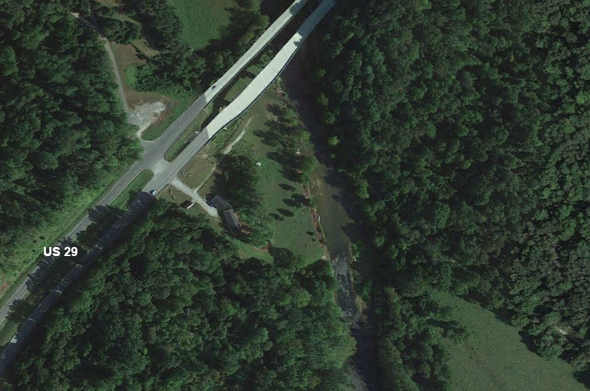
Quinn Dam Removal – 2007 (photo)
DWR partnered with the owners of the dam, the adjacent landowners, Virginia Organizing Project, American Rivers-NOAA and dedicated volunteers to remove this dilapidated dam from the Tye River near Rt. 29. The Tye is within the historical range of anadromous and catadromous fish species. Removal will also benefit resident fish species and allow for safe boating recreation as this is a popular paddling corridor.
Harrison Lake Dam Denil Fishway – 1989; reopened 1 mile
This 10′ dam forms 82-acre Harrison Lake on Herring Creek in Charles City County at the Harrison Lake National Fish Hatchery. The impoundment is used as a water supply for the hatchery. Historically, river herring ascended Herring Creek each spring to spawn. A Denil-style fishway was completed in 1989 by the U.S. Fish and Wildlife Service.
Walkers Dam Double Denil Fishway – 1989; reopened 30 miles
Located on the Chickahominy River near Lanexa, this double Denil fishway on Walkers Dam was rebuilt in 1989 by the City of Newport News to allow migratory fish to pass into the shallow Chickahominy Reservoir and its tributaries. Striped bass, blueback herring, alewife and American shad have been documented using the fishway.
Walkers Dam Double Denil Fishway Update
After a section of this dam failed in 2007, a major renovation was conducted by the owners of the dam (Newport News). During reconstruction of this dam a new double Denil fishway was installed, replacing the original fishway. Operation of the new fishway began in 2015. DWR has been conducting an electronic counting survey during the spring migration period at this fishway since 2017. Several hundred thousand fish are successfully using this fishway annually. The majority of the fish passing through are alewife, blueback herring and gizzard shad.
Harvell Dam Denil Fishway – 1998; reopened 5.7 miles
A Denil fishway was built on this 9′ dam located in Petersburg on the Appomattox River as a requirement of the owner’s Federal Energy Regulatory Commission hydropower license.
Harvell Dam Removal – 2014
This dam was removed from the Appomattox River in 2014. Using federal funding along with state matching funds DWR partnered with the owner of Harvell Dam to remove the dam, thus greatly improving fish passage up the Appomattox River. DWR has documented hickory shad, alewife, blueback herring and striped bass upstream of the removal.
Abutment Dam Denil Fishway – 2003; reopens 1.3 miles
DWR partnered with the City of Petersburg (dam owner), the USFWS and the EPA CBP to design and construct a 4′ wide Denil fishway on this dam (5’–7′) on the Appomattox River. The dam is approximately 1 mile downstream of Brasfield Dam (Lake Chesdin).
Abutment Dam Update
In 2009, a large section (>100’) of this dam collapsed in the middle of the river. This natural breach is now considered to be the main migration path for fish ascending the Appomattox. Removal of additional portions of the dam would further enhance passage.
Brasfield Dam Fish Lift – 2004
When Brasfield Dam was retrofitted for hydropower in 1993, the owners (STS Power at the time) constructed 90% of a fish lift to meet the requirements of their Federal Energy Regulatory Commission license. In 2004, the fish lift was completed because fish passage had been provided at the downstream dams (Harvell and Abutment; Battersea Dam was naturally breached). This fish lift is equipped with an observation window and a juvenile downstream migrant sluiceway that is designed to safely pass juveniles downstream and not through the siphon unit turbine.
Baber’s Mill Dam Removal
Baber’s Mill Dam was originally built in 1827 to power a saw and grist mill on Rock Island Creek, a tributary to the James River in Buckingham County. The dam was originally 10′ in height and the portion that was still blocking the stream was about 6′ in height. This was a barrier to migratory and resident fish species, and freshwater mussels, until the dam was successfully removed in April of 2024. DWR worked with Weyerhaeuser (owner) to obtain access for dam and stream surveying. DWR developed the removal plan including the associated drawings and facilitated obtaining the required permits. The USFWS provided a portion of the funding through a State Wildlife Grant to DWR and assisted with the Section 106 (historic resources) review process. The remaining balance of the funding was provided by Weyerhaeuser and an anonymous private foundation. Weyerhaeuser contracted a construction company with dam removal experience to carry out the project. Removal of this barrier reopened 45 Upstream Functional Network miles that includes all the stream habitat reopened on Rock Island Creek plus all other accessible tributaries above the former barrier. This is a great example of a public/private partnership formed to plan, fund and implement a significant ecological restoration project. Pre-removal fish community and freshwater mussel sampling was conducted, and post-removal sampling will monitor success of the project. Thousands of Sea Lamprey pass through the Boshers Dam vertical slot fishway at the upper end of the Piedmont to Coastal Plain fall zone each spring, and these native anadromous fish are now known to ascend Rock Island Creek. Their access to additional spawning and rearing habitat is no longer thwarted by Baber’s Mill Dam. Rock Island Creek was a DWR augmentation location for the endangered James Spinymussel a few years ago. A mature wild specimen (not from stocking) was recently discovered in the stream below the dam just prior to removal. Now that the barrier to the free passage of several likely host fishes has been removed these important mussels will benefit as well.
Rappahannock Drainage
Embrey Dam Removal – 2004/2005; reopened 106 miles of the Rappahannock and Rapidan rivers (video)
A multi-member partnership including Senator John Warner, DWR, City of Fredericksburg (owners), USACE, Friends of the Rappahannock, Stafford County and many others, planned, designed, raised funding for, and implemented the removal of this 22′ dam from the Rappahannock River in Fredericksburg. The initial breach was done by explosives (Army and Air Force demolition/dive specialists) in February of 2004 and by the spring of 2005 the rest of the dam was completed removed except for historical features such as the 1855 crib dam abutments and the 1910 Embrey Dam abutments.
Orange Dam Denil Fishway – 2003
The Town of Orange incorporated a Denil fishway into their new water supply dam (4′ high) on the Rapidan River as part of a permit condition to replace a failing water diversion structure. This 3′ wide fishway should pass resident fish species and American eel (catadromous; spawns in ocean, lives in freshwater). Embrey Dam no longer blocks passage to the watershed so if fish passage is established at Rapidan Mill Dam in Rapidan, anadromous fish such as American shad may reach and use this fishway. DWR, the USFWS and the USACE assisted the town with permitting, design and establishment of operation protocols.
Chandlers Dam Denil Fishway – 1995
DWR rebuilt this dam in 1995 after it failed during a heavy rainstorm. During reconstruction a 3′ wide Denil fishway was included near the main spillway of this 9′ high dam on Chandlers Run, a tributary of Cat Point Creek that flows into the Chickahominy River. River herring historically ascended this stream in the spring to spawn. Chandlers is a Department controlled public fishing lake.
White Oak Run Pool and Weir Fishway – 2005
The 1999 Rappahannock Basin Impediment Survey conducted by Virginia Commonwealth University (Richmond) for DWR using EPA Bay Program funds identified several herring blockages in the watershed. The Route 601 crossing of White Oak Run (trib of Muddy Run that flows into the Rappahannock near Fredericksburg) was selected for installation of a pool and weir type fishway to pass fish into and through the low water culvert pipe. The USFWS hydraulic engineering staff provided the design for the fishway. The Nature Conservancy provided mitigation Trust Fund funding for the project. The fishway was completed in 2005. In 2015 DWR documented successful passage of alewife and blueback herring through this fishway.
Potomac Drainage
McGaheysville Dam Removal – 2004
DWR partnered with the City of Harrisonburg, American Rivers-NOAA and Pure Water 2000 to remove this dilapidated dam from the South Fork of the Shenandoah River near McGaheysville, VA. The dam presented a hazard to boaters and was a partial blockage to fish migration. Resident fishes and American eel benefit from this dam removal project.
Knightly Dam Removal – 2004
DWR partnered with the adjacent landowners to remove this dilapidated dam that was partially blocking the Middle River, a tributary of the South Fork Shenandoah. The river was flowing around the dam causing severe erosion.
Rockland Dam Removal – 2005
DWR partnered with the adjacent landowner, American Rivers-NOAA and the Chesapeake Bay Foundation to complete this partial removal project on the North River, a tributary of the South Fork Shenandoah River. Half of the dam was completely removed and the other half was lowered and left in place to stabilize a wetlands-type area that had formed just upstream of the dam. This removal benefits resident fish species and American eel.
Riverton Dam Removal – 2005
DWR partnered with the USFWS and the City of Front Royal (owners) to remove this 8’ tall structure from the North Fork Shenandoah River. The dam was no longer serving any purpose. American eel passage was greatly enhanced along with restoring aquatic connectivity for resident fish species and other aquatic organisms such as freshwater mussels.
Potential Fish Passage Projects in Virginia
This list of proposed projects is not a complete list of all potential fish passage projects in Virginia.
Rapidan Mill Dam Removal
Originally, Rapidan Mill Dam provided hydro-mechanical power for a mill and more recently hydropower, which has ceased operations. The dam is now obsolete. This 12′ tall dam that spans 220’ across the Rapidan River in Rapidan needs a provision for fish passage to allow anadromous, catadromous and resident fish species access to native spawning and rearing habitat. With Embrey Dam removed (2005) the path up the Rappahannock and Rapidan rivers to Rapidan Mill Dam is unimpeded. DWR has collected adults of all four of the shad and herring species upstream of Embrey with American shad and blueback herring also being documented well up the Rappahannock above the confluence with the Rapidan suggesting that these fish also ascend the Rapidan. Striped bass are reaching Rapidan Mill Dam (anglers) and there is eDNA evidence that river herring (alewife and/or blueback herring) reach the dam (Plough et al. 2018). The eDNA researchers also found a river herring egg below the dam in 2015 confirming use of the Rapidan for spawning activity (Plough et al. 2018b). Thus, the dam is a confirmed impediment to anadromous fish.
Dam removal is the best approach to providing fish passage and creating aquatic connectivity for all aquatic species. This barrier is a Tier 1 (top 5%) priority in the Chesapeake Bay Fish Passage Prioritization Tool (updated 2023) and is a top priority for the DWR Fish Passage Program in terms of the anticipated benefits of removing the dam. American Climate Partners now owns the dam and has made the Rapidan Fish Passage Project its number one priority. The Rapidan Partnership, led by ACP since 2019, includes state, federal, ngo, and private partners collaborating on this highly important river restoration project. Because the next dam upstream (Town or Orange Dam) has a Denil fishway in place, over 1,000 Upstream Functional Network miles, which is all of the accessible stream miles on the Rapidan and its undammed tributaries, would be reopened by removing Rapidan Mill Dam. Applications for federal funding under the Bipartisan Infrastructure Law have been submitted by ACP with support from DWR. Ongoing preliminary work to prepare for the removal project continues to be in need of funding from donors and partners.
Ashland Mill Dam Removal
Formerly used for hydromechanical power to operate a mill, this dam is now obsolete. This 13′ tall dam that spans 210’ across the South Anna River near Rt. 1 is in need of fish passage to allow anadromous, catadromous and resident fish species access to native spawning and rearing habitat. American shad, hickory shad, blueback herring, alewife herring, striped bass, sea lamprey reach this dam each spring but cannot access historical upstream spawning and rearing habitat. Upstream migration of American eel juveniles is delayed by the dam. Dam removal would be the best approach to providing passage at this barrier that is a Tier 1 (top 5%) priority in the Chesapeake Bay Fish Passage Prioritization Tool (updated 2023). This dam is also a top priority for the DWR Fish Passage Program in terms of the anticipated benefits of removing the dam. A private firm is currently working on a plan to remove this dam for mitigation. The next very low head dam nine river miles upstream (Ashland Water Supply Dam) is likely passable during spring flow conditions so the removal of Ashland Mill Dam would reopen access to as many as 476 Upstream Functional Network miles.
Ashland Water Supply Dam
A simple notch might be needed at this low-head (3′) water supply dam on the South Anna River near State Rt. 54 in Hanover County to provide aquatic connectivity year-round. Because this is such a low dam, passage of target species such as American shad and river herring is highly likely during spring flow conditions. American eel juvenile migrations are likely not delayed at this dam year-round. There are 330 Upstream Functional Network miles above Ashland Water Supply Dam.