
Description
Taking Hall Road up Sinking Creek Mountain leads to fantastic views of the surrounding ridges and valleys of Craig and Roanoke Counties. This driving route starts at the intersection of SR-621/Upper Craigs Creek Rd. and Hall Rd. in New Castle and follows Hall Rd. for approximately 5.9 miles to its end at VA-42/Cumberland Gap Rd.
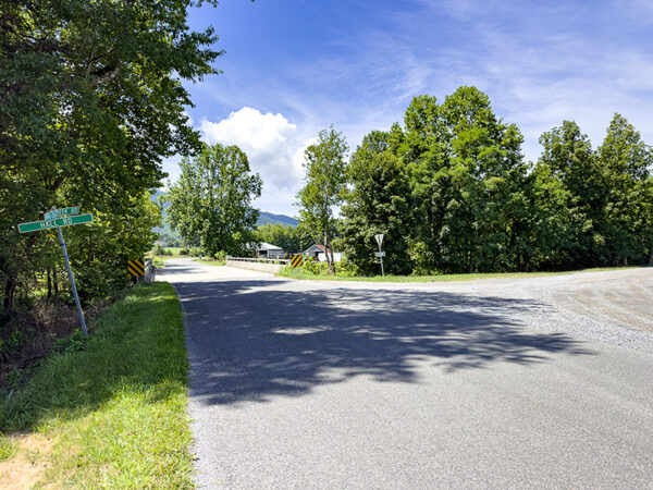
The driving route begins at the intersection of SR-621/Upper Craigs Creek Rd. and Hall Rd. Photo Credit: Lisa Mease/DWR
Drive slowly with the windows down to listen for wildlife as the road twists and turns up the mountain. About 2.8 miles from the start is an overlook that provides a beautiful vantage point of the ridge top surroundings and opportunity for raptor viewing. Turkey and black vultures, red-tailed, broad-winged, Cooper’s and sharp-shinned hawks are the most common species in this part of Virginia.

The open vista for raptor viewing. Photo Credit: Lisa Mease/DWR
The pull-off point approximately 1.7 miles from the overlook is a good place to park and explore. The forests on the ridge top support a variety of woodland species, such as red-eyed vireo, worm-eating warbler, and scarlet tanager in spring and summer. The roadside bushes in the area attract a variety of butterflies, with spicebush swallowtail being especially common along with the tiny eastern-tailed blue. The remaining 1.5 miles winds down the mountain through the forest. Along the way, listen for common raven, eastern wood-pewee, rose-breasted grosbeak, and ovenbird.
Notes:
- Hunting may occur in this area. Please wear blaze orange or pink for safety.
- As with all Virginia Bird & Wildlife Trail sites within the George Washington & Jefferson National Forests, please visit the Alerts webpage to check this location’s status before heading out.
Wildlife Sightings
94 species have been reported at this site to date.
Birds Recently Seen at Hall Road, Raptor Viewing Stop and Overlook:
Recent Checklists:
| Date | # of Species | Submitted By |
|---|---|---|
| 12 Jun 2025 | 9 | Kirk Gardner |
| 15 May 2025 | 15 | Michelle Illuminato |
| 21 Jul 2024 | 12 | Lisa Mease |
| 21 Jul 2024 | 12 | DWR Virginia Bird & Wildlife Trail Team |
| 29 May 2024 | 24 | Luke Headings |
Amenities & Accessibility
Amenities
Other Amenities: Wildlife Viewing by Car
Accessibility Considerations
This location does not have a Birdability Site Review available at this time
Learn more about Birdability’s efforts to map accessible outdoor spaces
Maps & Directions
GPS Coordinates of Starting Point: 37.396090, -80.213090
From Blacksburg, head north on US-460 Bus. W/N Main St, merge onto US-460 W/US 460 Byp/Pandapas Rd, turn right onto SR-621/Craig Creek Rd/Upper Craigs Creek Rd, and the starting point will be on the left in approximately 16.6 miles.
Site Information
Managed By:
- U.S. Forest Service
Access Requirements:
- Free; Open daily April 1st – January 10th
Contact Information:
- Eastern Divide Ranger District office, 540-552-4641
Sites, or portions of sites, can be closed periodically for management activities. Please always check the site’s website for additional information prior to visiting.