
Overview
The Little North Mountain Wildlife Management Area (WMA) is in southern Augusta and northern Rockbridge Counties. This WMA is long but narrow, stretching approximately 21 miles along the spine of Little North Mountain, the mountain for which it’s named. A very small area of the southern boundary touches State Route 39 and the Maury River in the Goshen Pass, which separates this WMA with the neighboring Goshen WMA to the south. For many years the Goshen and Little North Mountain WMAs were combined into one complex, but for a few reasons these areas were recently separated into distinct WMAs.
Little North Mountain WMA is 17,152 acres in size. It is characterized by a long, rugged mountain ridge with numerous secondary/spur ridges running off the mountain sides. Slopes are steep to moderate with numerous deep hollows/valleys with somewhat gentle topography found at lower elevations. Elevations range from 1,400 to 3,200 feet with most of the mountain and high ridge tops in the 2,800-to-3,000-foot range.
The WMA is primarily forested; comprised of mixed hardwoods dominated by oaks and hickories. Other forests found on the area include mixed hardwood and pine. Stands of table mountain and pitch pine with a dense mountain laurel understories can be found along a few of the mountain tops and spur ridges whereas the deep hollows and rich cove forests are dominated by tulip poplar. A few small open clearings occur in some areas, dominated by grasses and broad-leaved plants, but this habitat is very limited. Two large powerline rights-of-ways cross through the WMA, providing linear corridors of open, grass and broad-leaved plant dominated habitats.
Hunting
Sunday Hunting Opportunities on Public Lands in Virginia »
The Little North Mountain WMA offers hunters ample opportunities to hunt deer, bear, turkey, grouse and squirrels in a rugged mountain setting. Some rabbit hunting is possible but limited to the open lands described above. Several seasonal access roads allow for deeper vehicle access into the WMA during hunting seasons. In addition, there are numerous old logging roads that provide many miles of foot access.
Fishing
The Maury River in the Goshen Pass, on the southern boundary of the WMA, is included in DWR’s “put-n-take” trout program providing excellent trout fishing during certain times of the year. Additional fish species to consider within the Maury River are smallmouth and rock bass.
Other Activities
The large and extensive forests on the Little North Mountain WMA, open areas that are found in a few areas that serve an important role for wildlife, and frequent timber management activities add to the ecological diversity of this area. These aspects provide the wildlife viewer, naturalist, and nature photographer exciting opportunities to observe a diversity of wildlife, habitats, mountain views, and wildflowers. The WMA is never closed to public use, so viewers are welcome any time of the day, night, and year. Primitive, dispersed camping is allowed on the WMA; however, users must register with DWR prior to camping. Nearby are thousands of acres of the George Washington and Jefferson National Forest owned and managed by the U.S. Forest Service’s Glenwood-Pedlar Ranger District.
Facilities
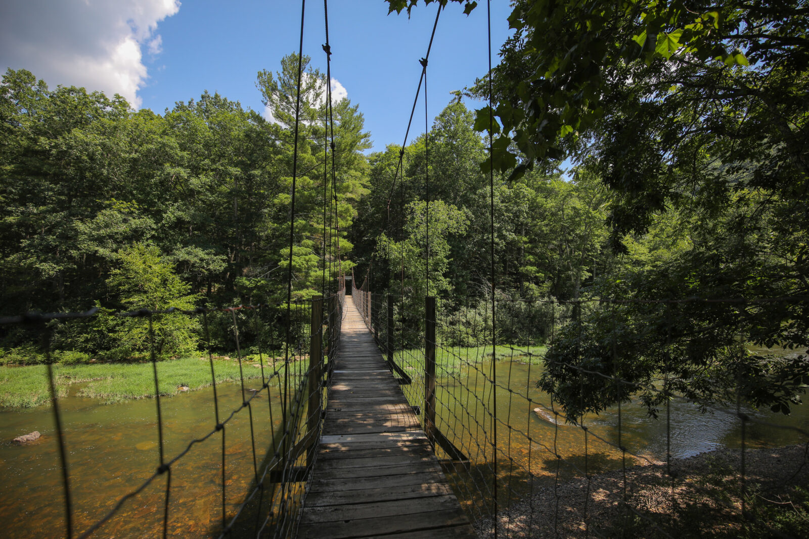
Numerous seasonally opened access roads, parking areas with informational kiosks, and old logging roads are located throughout the area to accommodate users. There is one parking area off Rt. 39 that provides access to the Maury River for angling and to a series of trails north of the Maury River. Access these trails and the WMA by crossing a suspension foot bridge over the Maury River.
Maps & Directions
The Little North Mountain WMA is located 14 miles northwest of Lexington, bordering Rt. 39 and the Maury River in the Goshen Pass, and 12 miles west of Staunton, starting just south of Buffalo Gap. Most of the WMA is best accessed from State Route 42 on the western side of the WMA. A few access points on the eastern side of the WMA can be reached by State Route 602 heading south from Swoope, VA. See the map for further details.
Map of Little North Mountain WMA
What To Know Before Visiting
A valid Virginia hunting or trapping license, fishing license, current certificate of Virginia boat registration, access permit, or current “Restore the Wild” membership is required to use this area.
- Map of Little North Mountain
- General WMA Rules
- A Visitor’s Guide to DWR Properties
- Primitive Camping on WMAs
Recreational Opportunities
- Hunting
- Trapping
- Primitive Camping (Requirements for Camping on WMAs)
- Warmwater Fishing
- Hiking
- Horseback Riding
- Wildlife Viewing