
Important Notices for this WMA
| Notice |
|---|
| Sunfish Pond Low Water NoticeDue to a leak in the stand pipe for the Sunfish pond the water levels will remain low and fluctuate. Anglers are prohibited from fishing in the immediate area of the stand pipe until further notice. Fishing can still be done from the parking area at the upper part of the lake but caution should be used due to the mud and sediment. Please also consider the Bullhead Pond or Bass Pond as alternatives when fishing at this area. |
Overview
Only 25 miles west of Richmond and conveniently reached from U.S. Route 60, the 4462-acre Powhatan Wildlife Management Area provides a haven for outdoors enthusiasts near an expanding metropolitan area. The area’s landscape of old fields, cultivated areas for habitat enhancement, wood lots and lakes provide for a diversity of wildlife species.
Once part of several farms, this gently rolling upland is well drained by several small streams that slowly make their way to Sallee Creek. Sallee Creek traverses the area northward on its way to the James River. Due to the past farming use of the area, and some of the current wildlife management practices of burning and disking, much of the area is in open fields. These openings, along with mature and newly emerging forests assure a diversity of wildlife cover types. The area’s acreage is contiguous although divided by Route 60 and has one privately owned interior property. Water on the area includes, four “farm” ponds and the twin Powhatan Lakes along with numerous beaver ponds and marshes along Sallee Creek. A small waterfowl impoundment exists just east of the crossing of Salmon Creek and the CCC trail. Elevations on the area range from 200 to 350 feet.
Hunting
Sunday Hunting Opportunities on Public Lands in Virginia »
Hunters will find a diverse set of game species on the Powhatan WMA. Deer and turkeys abound throughout the area and the moist soil and water around the beaver swamps are particularly attractive to woodcock and wood ducks. Small game hunters may pursue quail, rabbits, and squirrels within their preferred habitats.
Fishing
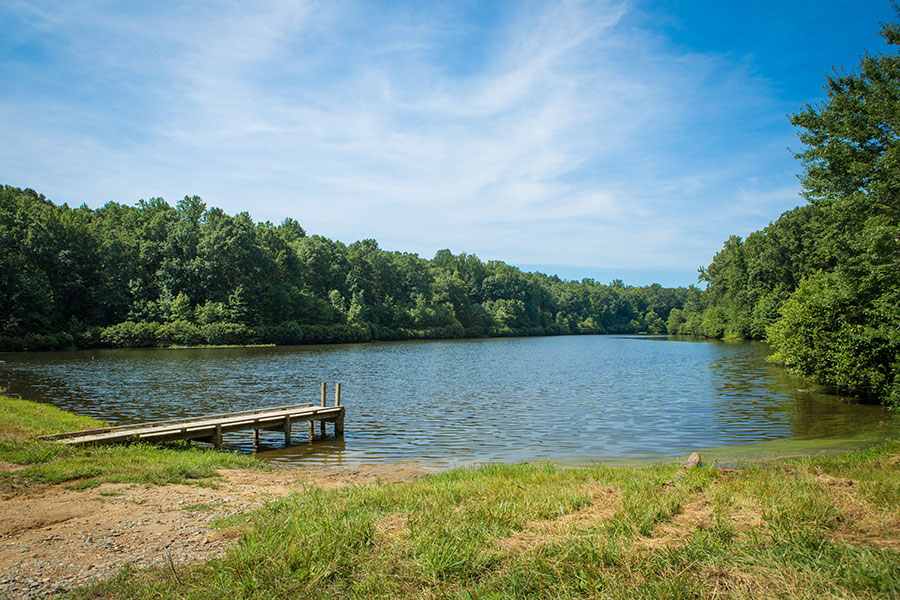
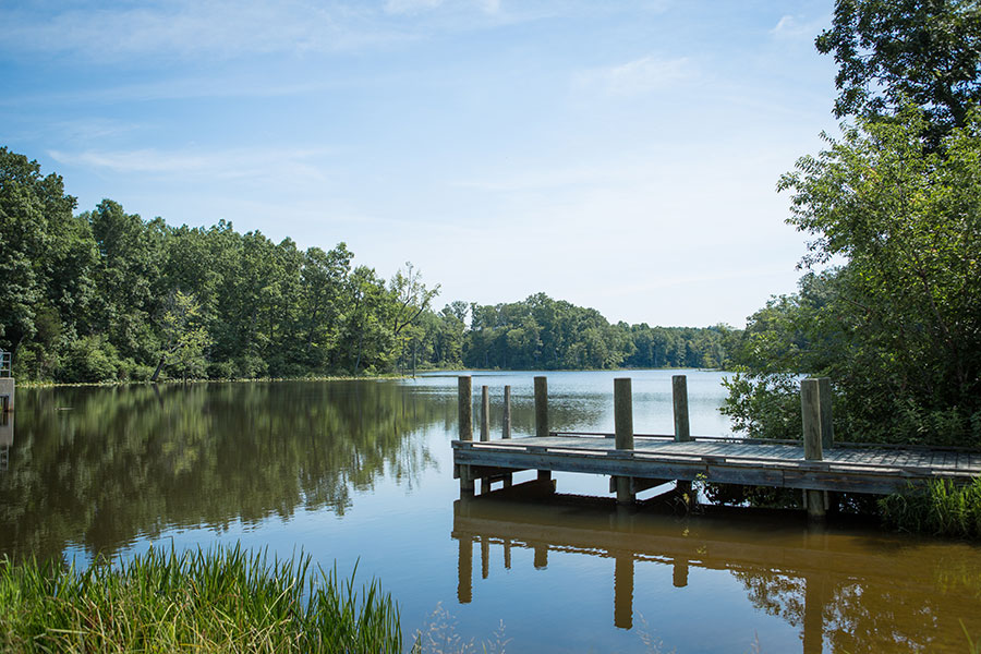
The Department’s Fisheries Division manages four ponds and two small lakes on the area. The lakes are 32 and 26 acres and are located in the northern portion of the area. There are facilities for launching small boats at both lakes. Submerged fish attractors have been constructed to improve fishing success. Available species include largemouth bass, black crappies, bluegills, chain pickerel, channel catfish, pumpkinseed and redear sunfish. The ponds range in size from two to nine acres. Boat launching facilities are available at the Bass and Sunfish ponds. Gas powered motors are prohibited on both lakes and all ponds.
Other Activities
Wildlife viewers will find ample viewing opportunities on the management area. The eastern and northern portions of the area with their expansive open fields and brushy habitat make excellent areas for glassing a variety of songbirds and raptors. The mature hardwoods attract a variety of interior forest species and make excellent locations to hear and possibly see owls. Both great horned and barred owls are common on the area. Deer and turkey can often be observed feeding along the edge of the fields that dot the landscape throughout the area. The beaver swamps, ponds, and lakes provide an attractive site to view wood ducks and geese along with a host of wetland bird species.
Facilities
The area has numerous easily accessible parking areas around its perimeter and at the lakes. A number of marked trails exist to provide visitors an opportunity to chart their course and choose their distance.
Maps & Directions
Powhatan Wildlife Management Area is in the center of Powhatan County, and readily accessible from U.S. Route 60 about 3 miles west of Powhatan Courthouse. From Route 60, turn north onto State Route 684 to access the northern part of the area and the two lakes. Access to the southern portion of the areas is from State Route 13 south; or from Route 60, south on Route 601 or 627. Consult the map for other roads, parking areas, etc.
Map of Powhatan WMA
What To Know Before Visiting
A valid Virginia hunting or trapping license, fishing license, current certificate of Virginia boat registration, access permit, or current “Restore the Wild” membership is required to use this area.
Recreational Opportunities
- Hunting
- Trapping
- Primitive Camping (Requirements for Camping on WMAs)
- Warmwater Fishing
- Hiking
- Horseback Riding
- Wildlife Viewing
- Boat Ramp(s)
Images by: Meghan Marchetti/DWR