
Overview
The Short Hills Wildlife Management Area (WMA) lies mostly within southern Rockbridge County with a small portion spilling into northern Botetourt County. This long, narrow and rugged WMA runs for 10 miles along the spine of Short Hills Mountain. The area offers challenging and rewarding hunting for various large and small game as well as hiking and wildlife viewing. The source springs and headwaters of Cedar Creek, the well-known creek that flows under the famous Natural Bridge, can be found here. Cedar Creek is a high-quality stream that supports a healthy native brook trout population in its headwaters.
Short Hills WMA is 4,232 acres in size. It is characterized by a long, rugged, high mountain ridge extending north to south over the entire length of the WMA with series of secondary/spur ridges running off the mountain sides. Slopes are moderate to steep with deep hollows/valleys and more gentle slopes found at the base of the mountain. Elevations of the WMA range from 1,320 to 3,200 feet, with most of the mountain spine in the 2,600-to-3,200-foot range. Cedar Creek flows north to south for about half the WMA’s length, creating a high-elevation deep valley with steep slopes between two higher ridges before turning east and exiting the area.
The WMA is mostly forested; comprised primarily of mixed hardwoods dominated by oaks and hickories. Other forests found on the area include mixed hardwood and pine. Stands of table mountain and pitch pine with a dense mountain laurel understory, along with mixed stands of pine and hardwoods occur on the rugged, rocky spine of the mountain for most of its length. Smaller areas of open fields containing a rich diversity of native and naturalized grasses and broad-leaved plants are present on the eastern segment of the WMA where it fronts State Route 610 (Plank Road). The property is also noted for its high percentage of karst topography, notably the exposed, rocky outcroppings on the spine of the mountain, which contributes substantially to water quality and cave habitats.
Hunting
Sunday Hunting Opportunities on Public Lands in Virginia »
Short Hills WMA is known for its good hunting opportunities. It boasts better than average populations of white-tailed deer, black bear, wild turkey, and small game. Access is limited to two parking areas off Plank Road on the East side, but the main access road there, along with old logging roads, provide ample access to more gentle topography and a wider diversity of habitats to hunt.
Other Activities
The large and extensive forests on the rugged spine and side slopes of Short Hills Mountain makes this an important habitat for many neo-tropical migrant and resident woodland birds along with a myriad of reptiles. Further, the open field complex on the lower elevation eastern portion of the WMA fosters a diversity of pollinator species. These aspects provide the wildlife viewer and naturalist exciting opportunities to observe a diversity of wildlife, habitats, and wildflowers.
The WMA is never closed to public use, so viewers are welcome any time of the day, night, and year. Primitive, dispersed camping is allowed on the WMA; however, users must register with DWR prior to camping. Nearby are thousands of acres of the George Washington and Jefferson National Forest serviced by the U.S. Forest Service’s Glenwood-Pedlar Ranger District.
Facilities
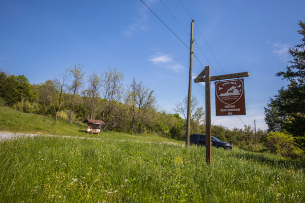
There are no public buildings, camp sites, or public bathroom facilities on the WMA. Vehicle access is limited, provided by one main parking area on Plank Road and a short, seasonally open road and parking area off Plank Road. Informational kiosks can be found at each parking area that provide maps and other pertinent information for users.
Maps & Directions
As mentioned, the Short Hills WMA is in Rockbridge County with a small segment in Botetourt County. It is located approximately 4 miles west of Natural Bridge, 10 miles southwest of Lexington, 32 miles northwest of Lynchburg and 26 miles east-southeast of Covington.
A one-mile segment of the WMA fronts Plank Road (State Route 610), which provides the only public access to the WMA. From Route 11 near Exit 175 off Interstate 81, Natural Bridge, follow State Route 609 (Red Mill and Cedar Creek Roads) west all the way to Plank Road. Turn South (left) on Plank Road and the main parking area will be on the right. Several other roads can get one from Route 11 to Plank Road, see the WMA map for more information.
Map of Short Hills WMA
What To Know Before Visiting
A valid Virginia hunting or trapping license, fishing license, current certificate of Virginia boat registration, access permit, or current “Restore the Wild” membership is required to use this area.
Recreational Opportunities
- Hunting
- Trapping
- Primitive Camping (Requirements for Camping on WMAs)
- Hiking
- Horseback Riding Prohibited
- Birding
Images by: Meghan Marchetti/DWR