Sites On This Loop
Description
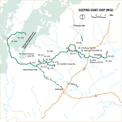
This loop begins at the top of Mt. Pleasant, a scenic peak that offers trails through deciduous woodlands that burst with warblers and other neotropical migrants in spring and summer. Ruffed grouse stuff along the entry road, and hundreds of swallowtails crowd every available wildflower. From the scenic views and warbler-filled woods of Mt. Pleasant, the loop descends east. Look back up U.S. Route 60 toward and over the Blue Ridge, and using your imagination, make out the silhouette of the Giant that gives this loop its name. The Giant rests comfortably on top of the mountain ridge. Allow your eyes to travel over the horizon to make out his head, belly, and feet. In fact, perhaps if you look intently enough, you may see his belly rise and fall in peaceful slumber. As you leave the Giant and continue on this loop, you reach four closely spaced medium-sized reservoirs. Each has something different to offer the visitor and a search of all four will invariably turn up something of interest. Waterfowl and shorebirds are the star attractions for the reservoirs, especially during migration when surprises such as grebes, loons, gulls or terns could appear. Once the weather warms and the waterfowl move further north, the reservoirs begin to buzz with damsel- and dragonflies along the shore while great blue and green herons wade the shallows.
Loop Map

Services
Amherst County Chamber of Commerce
434.946.0990
office@amherstvachamber.com
Nelson County Chamber of Commerce
434.263.5971
Nelson County Department of Economic Development and Tourism
800.282.8223
mcorum@nelsoncounty.org

