
The South Fork Shenandoah River begins at the confluence of the North River and South River near Port Republic and flows north 97 miles to meet the North Fork Shenandoah at the Town of Front Royal. The South Fork Shenandoah watershed covers 1,650 square miles. Surface runoff from the western slope of the Blue Ridge Mountains, parts of the Allegheny Mountains, Massanutten Mountain, and ground water from the karst regions of the Shenandoah Valley and Page Valley make up the flow of the river. The South Fork is a fifth order stream and averages around 100 feet in width. The substrate of the river varies from bedrock to cobble and boulder. Several species of rooted aquatic vegetation are found throughout the river. This vegetation can become quite dense during the summer months. The South Fork is typically low gradient, but does produce some class I and class II rapids. There are three low-head hydropower dams located on the South Fork Shenandoah. Dams at Shenandoah, Newport, and Luray are owned by Allegheny Power and operated as run-of-the-river hydropower projects.
The South Fork Shenandoah is a very popular destination for canoeists. The close proximity of the river to urban areas of Virginia and the aesthetic beauty of the valley attracts thousands of river users each year. Several canoe outfitters operate on the South Fork and canoe/tube traffic can be heavy on certain sections of the river during the summer months. Twenty (20) public access points along the entire length of the river creates the opportunity to plan many different float trips of varying distances. Except for the public access points and small sections of George Washington National Forest land on the west bank of the river, the majority of the land bordering the river is private property.
Maps & Directions
Note: All float descriptions are based on normal river flow conditions. Difficulty and safety considerations may vary according to changes in water level and flow.
Port Republic to Island Ford Map
Distance: 10 miles
A boat ramp was constructed by DWR at Port Republic at the confluence of the North River and South River. This facility can accommodate up to 25 vehicles and is one of the most scenic spots on the South Fork of the Shenandoah River. As you approach a big island about one mile below Port Republic, take the channel to the right. It is deeper and provides better fishing that the left-hand route. Portage your canoe (to the left of the dam), as running it is impossible. Long, flat runs and pools provide exciting redbreast sunfish angling. Smallmouth bass can be taken in fair numbers along this reach.
Island Ford to Elkton Map
Distance: 7 miles
A picturesque float, the South Fork meanders through farmland, once again providing excellent redbreast sunfish and rock bass fishing opportunities in the deep pools, and lots of small smallmouth bass action in the riffles. A Class I – II waters with one small ledge below Island Ford. Look for the DWR landing on the right-hand side of the river going downstream near the Rt. 33 bridge.
Elkton to Shenandoah Map
Distance: 7 miles
Put in at the DWR boat ramp at Elkton and rig up a small crayfish imitation for some smallmouth bass excitement. Get out of your canoe occasionally to wade the riffles and runs for best bronzeback results. Rock bass and redbreast sunfish add to the angling fun. A long power pool exists behind the 10-foot high dam at the town of Shenandoah. Pig-and-jig for largemouth bass or use live minnows for a trophy musky. Take out is on the right side of the river above the dam.
Shenandoah to Grove Hill Map
Distance: 8 miles
Access the river at the Allegheny Power “hand-launch” access site directly below the Shenandoah Dam. People launching canoes/kayaks at this site will have to park their vehicles upstream of the Dam at the parking area provided at the Town of Shenandoah/DWR access site. Takeout at the DWR dirt ramp on the right at Rt. 650 just downstream of the U.S. 340 bridge.
The river is accessible only to canoes/kayaks at the location. This is an easy float mixed with flat stretches and Class I rapids. This stretch has numerous smallmouth bass, rock bass, redbreast sunfish, musky, channel catfish, and in the slower reaches largemouth bass and bluegill.
Grove Hill to Newport Map
Distance: 6 miles
Access is at a DWR ramp located on Rt. 650 near Grove hill. The takeout is on the left, downstream from Newport on U.S. 340. Both access sites have concreate ramps. This section of river is comprised of several large pools and allows the angler a chance to fish for muskellunge, largemouth and smallmouth bass, bluegill, redbreast sunfish, and channel catfish.
CAUTION: Be aware that halfway to the Newport Access there is a large hydroelectric dam. Boaters can legally portage around the dam on the right side of the dam facing downstream.
Newport to Alma Map
Distance: 3 miles
Launch at the DWR ramp located north of Newport on U.S. 340 and takeout on the right side of the river upstream of the U.S. 340 bridge at Alma. Both access points are primitive and not recommended for trailers. This section is riddled with Class I riffles and runs which provide for quality smallmouth bass and rock bass fishing.
Alma to White House Map
Distance: 7 miles
The DWR access site at Alma is located just upstream from the U.S. 340 bridge on the right side of the river. The takeout is downstream of the U.S. 211 bridge on the right bank and can be accessed by Rt. 646. The Alma launch site is primitive and trailers are not recommended.
This stretch has a diversity of habitat: pools, runs, and riffles that provide angling opportunities for smallmouth bass, rock bass, muskellunge, sunfish, and channel catfish.
White House to Massanutten Map
Distance: 4 miles
The DWR ramp at White House can be accessed from U.S. 211 by taking Rt. 646. The takeout at Massanutten is on the left bank of the river and can be reached from Rt. 615. Both ramps are concrete and can be utilized by trailers.
The river in this stretch is characterized by large pools which provide excellent musky habitat.
Largemouth bass, bluegill, and channel catfish may also be found in the deeper pools, while smallmouth bass and rock bass may provide action in the riffle and transition areas.
Massanutten to Inskeep Map
Distance: 3 miles
The Massanutten DWR ramp can be reached from Rt. 615. The takeout at Inskeep can be reached off Rt. 675, downstream of the bridge on the left bank. Trailers cannot access the Inskeep ramp. This float has a dam that must be portaged halfway through the float.
This section of river has many pools and provides excellent muskellunge, largemouth bass, and smallmouth bass habitat.
Inskeep to Foster’s Map
Distance: 9 miles
Access to the Inskeep DWR ramp is from Rt. 675 on the left bank of the river downstream of the bridge. The Inskeep ramp is primitive and trailers are not feasible. Takeout at Foster’s on Rt. 684 on the left bank of the river. A Forest Service canoe ramp at Bealer’s Ferry is located approximately � of the way from Inskeep, also on the left bank.
A diversity of habitats are found in this section of the river as riffles, runs, and pools which provide angling opportunities for smallmouth bass, rock bass, muskellunge, redbreast sunfish, largemouth bass, and channel catfish.
Foster’s to BentonvilleMap
Distance: 18 miles
Foster’s can be accessed from Rt. 675 downstream of the bridge on the left bank of the river. The DWR takeout ramp at Bentonville can be reached from Rt. 613 downstream from the bridge on the left bank. Three Forest Service canoe ramps are located between the Foster’s and Bentonville ramps. The Forest Service access points are Goods Landing (2 miles), Seakford (6 miles), and Batzell (11 miles). Canoe and trailer access is available at the Foster’s and Bentonville ramps.
This section contains numerous Class I and Class II rapids which provide excellent canoeing and fishing. The best angling opportunities in this section will be for smallmouth bass, rock bass, and redbreast sunfish.
Bentonville to Simpson
Distance: 9.5 miles
Put in at Bentonville DWR ramp on Rt. 613. Takeout at Simpson DWR access on Rt. 623 (canoe access only). A rough trailer ramp in located at Karo (Rt. 340) approximately � mile upstream from Simpson. A shallow section of river with mostly rocks and ledges makes this good smallmouth territory. Class II rapids between Karo and Simpson could add a little excitement to the trip.
Simpson to Front Royal
Distance: 6 miles
Put in at DWR ramp on Rt. 623. Access limited to canoes only. Takeout at Front Royal boat ramp on Rt. 681. This section is shallow, with lots of riffles and rock cover. It is a fairly easy float with good smallmouth bass cover.
Front Royal to RivertonMap
Distance: 4 miles
Put in at Front Royal DWR boat ramp on Rt. 681. Takeout on Riverton boat landing, 1/4 mile upstream on the North Fork. This section offers good smallmouth fishing along with an easy, short float. There are some good deep pools near the end.
Fishing
Smallmouth Bass
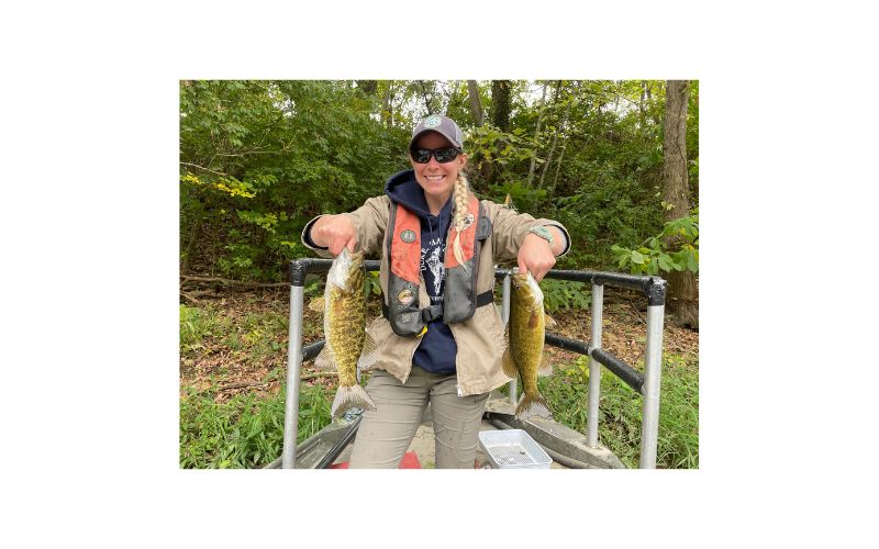
Serious smallmouth anglers know the Shenandoah River is one of the top smallmouth bass rivers in the eastern United States. Historically densities of smallmouth in the south fork have been among the highest in the state. Smallmouth bass catch rates can average up to three fish per hour. Fisheries biologists consider catch rates greater than one fish per hour to be very good. Remember, fishing success can vary depending upon environmental conditions. Due to the high densities of bass, growth weights are slightly slower than the Main Stem downstream. The south fork is considered a numbers fishery rather than a trophy water, however fish upwards of 20” can be found. The natural mortality rate of smallmouth bass in the Shenandoah is high and harvest by anglers is low, based on research conducted by biologists. Therefore, the smallmouth bass population is mostly controlled by environmental influences (floods/droughts). Years where there is a very successful spawn produces a strong “year-class” of bass. These strong year-classes are what makes fishing favorable. When one or two strong year-classes of bass are reaching sizes that anglers target, fishing can be excellent. However, when weak year-classes are produced by environmental factors, fishing success can be poor. Currently, there are several below average year-classes of bass recruiting into the fishery. This has caused a decline in the overall population. However, a higher percentage of quality bass exists as a result. Anglers will find smallmouth throughout all habitats on the river. One of the most productive areas to find smallmouth on the Shenandoah are directly below riffle areas or bedrock ledges. These areas provide cover and transport food items directly to waiting smallmouth. Overall, anglers should target structure closely associated with faster currents when hunting smallmouth. Various types of artificial lures and live baits can be effective for catching smallmouth on the Shenandoah. Anglers should not limit their fishing for smallmouth to just the warmer months. Smallmouth are active throughout the year and some of the larger fish are caught during the colder months.
Largemouth Bass
Largemouth bass do not gain as much attention as their cousin the smallmouth bass, but the South Fork Shenandoah is home to a good largemouth population. Largemouth are common throughout the river within the natural and dammed pools. Good numbers of quality-size largemouth bass are available to anglers. Largemouth up to seven pounds have been sampled by biologists in recent years. One of the best locations to encounter largemouth is near woody debris that accumulates along the banks of the river. These areas provide cover and attract small sunfish the preferred prey of largemouth.
Sunfish
The South Fork Shenandoah River is home to several sunfish species. They include: redbreast sunfish, rock bass, green sunfish, bluegill, and pumpkinseed sunfish. All the sunfish species tend to occupy the same habitats. They prefer to congregate in areas with reduced current and quality structure. The redbreast sunfish may also be located in areas with faster currents. Sunfish densities are excellent and the number of larger “hand-size” panfish is outstanding . Seven to eight inch sunfish are quite common in the Shenandoah River.
Crappie
Both black and white crappie inhabit the South Fork Shenandoah River. The black crappie is the most dominant of the two species. Crappie densities tend to be low and the only areas they can be encountered in fair numbers is in large, deep pools. Crappie like structure and will typically be found near the main channel of the river. Since crappie exhibit “schooling” behavior, where one is caught others are sure to be near. Anglers should try small jigs and live minnows when targeting crappie.
Muskellunge
DWR annually stocks fingerling-size musky at several sites on the South Fork Shenandoah River from Port Republic Landing to Riverton Landing. Musky are able to spawn but it can be highly variable, therefore they must be stocked to sustain a fishery. Adult musky densities are excellent, but pool habitat is the limiting factor. Find a deep pool and you will find a good number of muskies. Musky are “ambush” predators and often lie just off the main channel waiting for a meal to float or swim along. Also remember these fish are a “cool-water” species that is active even during the coldest months of the year.
For more information about fishing for Musky, see this Muskellunge profile.
Channel Catfish
Channel catfish are extremely plentiful in the South Fork. Recent sampling by DWR biologists indicated a healthy catfish population dominated by quality-size (2-4 lb) fish. Some 10+ lb individuals were also collected. The large pools in the river are the best place to locate channel cats and their population density increases dramatically as you move downstream. Those looking for larger cats should try the South Fork, as they grow larger here compared to the Main Stem Shenandoah. Anglers should take advantage of the catfish spawning season when the water temperature reaches the low-mid 60’s (F). Channel cats will move out of the deeper pools, usually heading upstream, and congregate at the head of pools in shallower water. Unlike other fish that do not feed during spawning, catfish feed heavily during this time. Even though most people think that you can only catch catfish after dark, anglers can also have success during daylight hours. Commercial catfish baits, homemade “stinkbaits”, cut bait, and some live baits can be used to catch channel catfish.
Flathead Catfish
Unfortunately, flathead catfish were accidentally or illegally introduced into the South Fork. The first fish was captured by biologists below the Newport Dam. Since then, biologists have documented that the population is now reproducing. The population is still in its infancy and isn’t evenly distributed throughout the river. It will take a number of years to determine how large these cats can grow, how much the population will expand, and what type of impacts they may have on other fish populations within the system. It is illegal to catch fish and stock them into public waters without a permit. Do not move these fish! Flatheads love live bait. Anglers should target large boulders and debris piles to catch them.
Other Fish Species
American eel, white sucker, northern hogsucker, common carp, yellow bullhead, and redhorse are some additional fish species commonly found in the South Fork that anglers may encounter.
Shenandoah, Cowpasture, and James River Fish Kills update
Biologist Reports
Regulations
From the confluence of the North and South Rivers in Port Republic to the confluence of the North Fork and South Fork Shenandoah in Front Royal.
- Black Bass (Smallmouth and Largemouth): 5 per day. No bass 11-14 inches can be harvested.
- Sunfish: 50 per day. No length limit
- Rock Bass: 25 per day. No length limit
- Crappie: 25 per day. No length limit
- Muskellunge: 1 per day. Minimum size 40 inches
- Channel Catfish: 20 per day. No length limit
- Flathead Catfish: no daily creel limit
More Information
For more information about the South Fork Shenandoah River, please contact:
Fishing, boating, and general information:
DWR Verona Office
517 Lee Highway Verona, VA 24482
Phone: (540) 248-9360
Shenandoah State Park
Virginia Department of Conservation and Recreation
Raymond R. “Andy” Guest Jr.
Shenandoah River State Park
Daughters of Stars Drive
Bentonville, VA 22610
(540) 622-6840
Camping & river access
United States Forest Service
George Washington National Forest
Lee Ranger District
102 Koontz St.
Edinburg, VA 22824
(540) 984-4101
Accommodations, outfitters, and guides
Harrisonburg-Rockingham County Chamber of Commerce
(540) 434-3862
Luray-Page County Chamber of Commerce
(540) 743-3915
Front Royal-Warren County Chamber of Commerce
(540) 635-3185
River conditions / water levels:
United States Geological Survey
(804) 261-2600
www.usgs.gov
River issues / water quality
Friends of the Shenandoah River
P.O. Box 410
Front Royal, Va 22630
www.fosr.org